1/15 - SIUE
2/26 - Greensfelder
3/12 - Matson Hill
3/26 - Indian Camp Creek
4/9 - Greensfelder
4/23 - Matson Hill
5/14 - Castlewood
5/21 - Cliff Cave
6/4 - Indian Camp Creek
December Meeting at TAP ROOM
Just a friendly reminder that next week's December 1st GORC monthly meeting will be held at the usual location - the Schlafly Taproom downtown at 7pm.
Come on out as it's our last meeting for 2010 and we hope to see everyone there.
Come on out as it's our last meeting for 2010 and we hope to see everyone there.
Poll Question - Integration or Not? Read On...
Being a more complicated poll to explain, I've added a description here so you can be more informed.
The club has been approached to join forces with IMBA and integrate into their membership system. IMBA is pushing a Chapter program. Basically, all the membership would go through IMBA and we the club would receive 40% of the fees people pay to IMBA. All independent fund raising would still be 100% ours. Insurance costs would still be our responsibility. IMBA would take care of all the membership expenses with renewals, cards, that sort of thing. The GORC website would theoretically be a content managed site using IMBA's back-end civiCRM data-driven system. The website would look more like a portal website (joomla-based more than likely) and would also keep track of members.
In other words, regarding the poll below, would you be willing to join IMBA to support GORC or would you rather us (GORC) remain independent and we get 100% of the funds (your membership and donations). The big unknown is whether our members are BOTH IMBA and GORC members simultaneously.
Make sense? Now go cast your vote to let us know your thoughts. Feel free to comment on the forum or on this blog post.
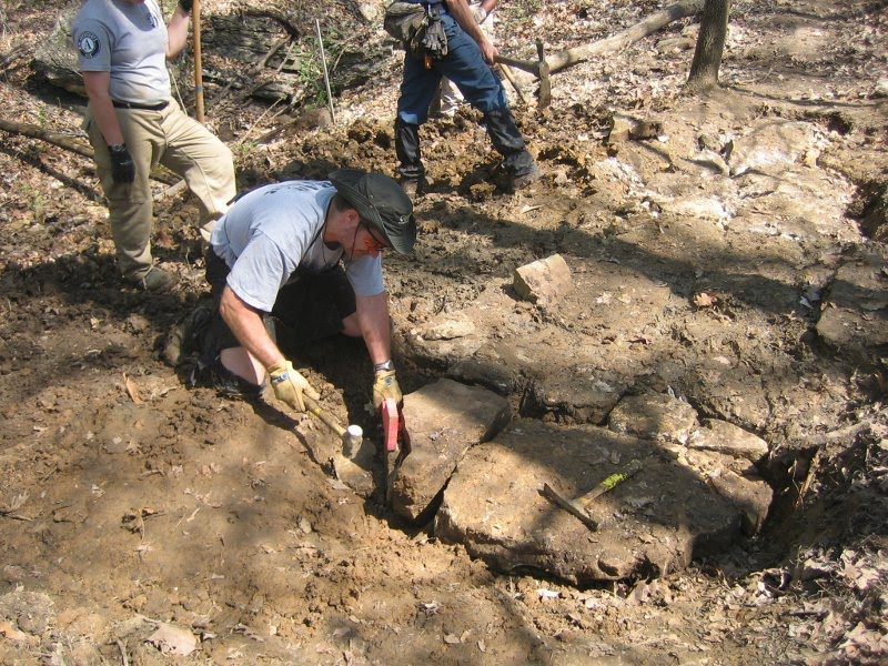
Rock Hollow Workday-- Saturday, November 20th 9am-1pm
This Saturday, Nov 20th at 9am is the first workday in Rock Hollow. We will construct one of the difficult creek crossings on the east side of the hollow, to demonstrate our skills, and to provide a model for the PTBA bidders that will eventually build the trail.
Sue Bell, County Parks volunteer coordinator, projects there will be 80+ people there, so we need as many workday leaders as we can muster. We will meet at the Ridge Meadows School parking lot, on Ridge Rd, just south of Old State Rd.
Please everyone, show up, we need to make a good show. More information, including directions can be found here.
Cranksgiving 2010: A Pictorial
Lisa and I decided, at the last minute, to check out the 2010 Cranksgiving ride last weekend. I'd heard about the charity ride a couple of years ago but never got around to actually participating.
It's pretty cool to say the least. Cranksgiving is an organized ride approximately 24 miles in length, is a loop on commonly ridden roads - think Dogfish training ride, and stops by five supermarkets. Participants are asked to buy in total about $10-$20 worth of canned goods at one or more of the grocery stores. Riders are asked to carry the goods back to the start where they are displayed to show the enormity of hundreds of people donating the goods to Food Outreach. However, at a few stops the St. Louis Adventure Group (SLAG) worked sag so riders didn't have to lug heavy cans on their backs - you definitely want a messenger bag or backpack.
Apparently the St. Louis version is the fastest growing and had the largest turnout last year - 500 riders. This year's addition saw over 800 people and it was quite impressive seeing everyone riding single file (mostly) down Adams Road to Ballas.
We went in style as I borrowed the GORC full-squish BOB trailer and towed all the goods we purchased back to the start/finish. The cross bike felt a little squirrely near the end with about 30 pounds of canned goods following behind. And let me clarify the importance of the start/finish ..... at the Schlafly Bottleworks in Maplewood. The organizers, BicycleWorks, among others, know what riders want after a workout. Yup. Carbs.
Yes, it wasn't on dirt, and no, it didn't involve building trail, but it was for a good cause, got us on our bikes, and was very enjoyable... and great beer. I'd recommend it to other GORCers to attend the 2011 edition.
Here's some snaps we captured throughout the day.
 Hybrid Turkey
 Rolling start in Maplewood with police escort
 Straub's in Webster Groves getting the treatment. Pick your canned goods wisely or you will pay, literally.
 Determining the dynamic load bearing optimization flow ratio. I never solved the equation.
 World's most useful kickstand
 Approaching Cranksgiving headquarters - I smell hops. Notice the World Cup socks driving the bus that failed to achieve any semblance of speed and proved my lack of endurance and stamina is, in fact, quite real.
 The wall of donations that arrived by bike. This is an early shot before the sag wagons arrived with about the same amount of goods.
 Bottleworks bike parking. We saw the entire range of two-wheeled rides; cross bikes, clapped out beaters, tandems, NEXT/Pacific/enter-chinese-extreme-brand-here 11 inch travel freeride rigs, mountain bikes, hybrids, road bikes made of rusty steel, "" made of nice steel, titanium wonder rigs, carbon fibre - that's proper English - for the French-made Look featherweights, vintage Klein crust bikes featuring never-before-seen Brooks premium saddles, a bike with a fur saddle (extinct megafauna?), kids bikes, trikes for adults who never learned to ride and would prefer to slide under a Prius at a 4-way stop, hippies on 75cm road bikes with head tubes longer than your top tube, racers on race bikes, moms on race bikes, moms on hybrids, dads on powder blue Varsities, and on and on. You get the idea. All walks of life, all budgets, all liking the bike riding part. Better than the Moonlight Ramble (not as crowded), safer than the old Critical Mass disasters (less scary participants featuring kwik-kopy manifestos).
 Drink on, you deserve it. Hot Liquor Porter, I'll have another. Next year - wide right turns tandem with BOB trailer?
Cliff Cave Map

Well, it was 5 years in the making, but it's finally here! The official GORC map for Cliff Cave County Park.
This can serve as another example of how someone who wants a trail somewhere decides that they're going to do what it takes to make it happen. There was no map, because there was no one with such an interest in Cliff Cave until recently. Enjoy the trails. The pdf version of the file will be here shortly.
GORC Water Bottles
Momentum Cycles now stocks water bottles with the ultra exclusive GORC logo emblazoned on them. Proceed at once to your local Momentum shop and pick up one, two or a dozen. Momentum has graciously offered to share $1 from the sale of each water bottle with GORC. So, you get to stay hydrated, Momentum get's your business and GORC get's your money to help build trail! Supplies are limited, so don't delay.


Cliff Cave Workday/Appreciation Party-- Saturday, Oct. 30th
When: Saturday October 30th
Where: Cliff Cave Park
Directions: From I-255 take Telegraph Rd. south 1.7 miles to Cliff Cave Rd.
Turn left onto Cliff Cave Rd. and continue 1 mile into park.
Details: We will meet at the pavilion. Start time is 9:00am and will work until 12:30 or so.
What to bring: Sturdy shoes, gloves, eye protection and something to drink. For a more detailed description, it's a good idea to read Pilznr's post at http://gorctrails.com/board/topic.asp?TOPIC_ID=3711
Please contact Sue Bell if you plan to attend.
314-615-8822 or e-mail sbell@stlouiscounty.com
Lunch will be provided by St. Louis County Parks, so please let Sue know if you are coming so she can plan for food.
Those that attend the workday will be rewarded with an opportunity to win an attendance prize provided by:
South County Cyclery and Olde Towne Fenton Cyclery, as well as Crusoe's Restaurant!
What we're doing: Cliff Cave Park has 2 trails Spring Valley and Bluff Trail.
We will be concentrating first on the Bluff Trail, we have 1/2 mile of new trail to build. This will eliminate several unsustainable sections and provide for a fun ride in both directions.
We also have several short re routes flagged on the Spring Valley loop. These will eliminate a couple short, non draining spots.
If attendance provides, we will put these in as well, so everyone come out and help!!
After the workday will be GORCs annual Appreciation Party!!!
Will have a ride, mother nature permitting.
More info on the message board.
Of Berryman and Men
The Berryman is amazing.
The Berryman is difficult.
The Berryman is slowly wasting away.
These statements are all true. They have been for 20+ years. While I do not want to write a small book on the trail I will, however, explain the benefits of having the Berryman Loop within 120 miles of your front door.
The Berryman Trail is a loop of singletrack in the Mark Twain National Forest that serves hikers, equestrians and within the last 30 years, mountain bikers. It was built by the Civilian Conservation Corp - CCC for short - which was instituted shortly after the Great Depression. The Berryman Trail is an approximately 24 mile loop that features over 2,400 feet of climbing, several creek crossings and the scaling of over 12 Ozark hillsides. The trail follows creek valleys, climbs ancient Ozark hills and descends into several rocky outcroppings.
The Berryman Trail was classified as an IMBA Epic in 2002. The trail best features the "feel" of Missouri backcountry trail riding. There are many reasons that bikers continue to ride the Berryman.
But there's one major draw… The Berryman Trail is a LOOP.
You can't say that about any other portion of the Ozark Trail network. The Berryman Trail may be the largest loop in Missouri that doesn't need other trail connectors or roads to call it a true loop.
And the best part that the original designers may or may not have grasped is that there are several legitimate bailout options. Options that allow injured or destroyed folks to limp back to their cars via the "central" firewood that pierces the trail's core. On top of that, there are two major trailheads that feature camping.
True, the Berryman is suffering every trail's worst nightmare. Continued use in the muddy season, motorized use (ATV/dirtbike) and fall-line climbs are contributing to its "erosion issues". All of these issues combined would absolutely murder an average trail. But for some reason the Berryman is losing its foothold much more slowly. Sure, the switchbacks in some areas are grossly eroded but then think, really think, of the sweet, glossy-buff sections of trail that thread through the pines or hug the edge of a precipice. In the dry season the Berryman rails but in the wet the trail leaves you for dead. But you shouldn't be riding it when it's wet, remember?
Ignoring the switchbacks that would be more accurately called slides that drop into the Brazil Creek campground and the areas that require riders to know how to loft their front end chin-high in spots, the Berryman isn't out to destroy you - it simply wants to make you a better Missouri Ozark trail rider. If you use the Berryman as your training ground then you will be almost unstoppable - except West Virginia.
Simply put, the mere FACT that you can link up the Ozark Trail (hundreds of miles!) and Council Bluff is unfathomable to other folks. Missouri has a trail network that other states would die for - and it's all about 120 miles from your kitchen sink.
Spread the word.
2010 Brown County Break Down - Pictorial
Lisa and I (Matt) decided to check out the Brown County Break Down after riding there multiple times and reading about the event. So on a whim we signed up and checked it out.
Here's a quick pictorial of the event. There aren't many photos because the trails are too fun to slow down and snap pics...
 Everyone waiting to get started - about 500 riders
Here's a quick pictorial of the event. There aren't many photos because the trails are too fun to slow down and snap pics...
 Everyone waiting to get started - about 500 riders
 Near the homebase setup headquarters
 Riders were staged based on distance (100/75/60/40/20 miles) and within the mileage by speed - fast, average, leisurely.
 About to enter the first trail. On Saturday this parking lot was full of product demos from Scott, Trek, Cannondale and Giant.
 Hesitation Point - at the top of the 2 mile climb then doesn't womp you on the way up. Very fun on the way down and where they hold their Super D races earlier in the year.
 A small sampling of their trail armoring work. With 95% of Brown County's trail being dirt they take great care to ensure the singletrack doesn't erode or become a bog.
 At the 40 mile end point - featuring live bluegrass music and food.
 A view of the historic cabin and live band
If you ever find yourself wondering about Brown County State Park then check this out.
Annual GORC Appreciation Party

This edition of the volunteer appreciation party will feature a poker run. Yep. We are holding the party earlier this year instead of the traditional GORC birthday of December 12th when we typically freeze to death. We're hoping for great weather and a large turnout so we better see you October 30th. Bring candy, too, Matt says so.
Look for more details on the GORC website either on the message board or home page as the date nears. We would like to get a head count so be sure to post up on the board.
DON'T FORGET YOUR COSTUME -- it's halloween weekend after all!
St. Louis County Parks Trail Hotline
With last year's trail vandalism at the Chubb and now with the painful extraction of some monkeyheads at Greensfelder we at GORC felt it was high time to post the St. Louis County Parks Trail Hotline - 314-615-8911. Now we can all help police our favorite trails.
This hotline is for St. Louis County parks only. Parks include West Tyson (Chubb), Cliff Cave, Creve Coeur, Greensfelder and ALL of St. Louis County's parks.
If you encounter somebody destroying trail first-hand be sure to get involved by calling the hotline at 314-615-8911. Approach the individual if you feel comfortable and respectfully explain that he or she is wrecking the trail through their grooming actions.
Never start a confrontation and remember they probably think they are IMPROVING the trail. However, no matter the situation, always let the county parks staff know that this is occurring so they can better protect their valuable trails.
BERRYMAN Epic-alness
October 23rd, Berryman Epic, version 3.0
Look out for some great racing on some of the best backcountry Missouri trails with 200+ of your racing friends. The race is on Saturday so you can party down through the night, stumbling back to your campsite at the ever-so-friendly Bass River Resort.
Get ready for 56 miles of BEST EVER.
GORC will be assisting the organizers in preparing the course in the coming weeks by cutting out any deadfall and securing the route.
We will see you there!
BURNIN!
It's time for the 7th Annual Burnin' at the Bluff - this weekend. The classes are completely stacked this year and the weather outlook is absolutely killer. Several GORC members will be racing the 12 hour challenge around Council Bluff Lake and a few others will be PATROLLING the course to keep everyone safe. If you see a patroller out there let them know you appreciate their presence.
See everyone this weekend!!!!!
See everyone this weekend!!!!!
Lost Valley Workday- Saturday, October 2nd
We're going to do some well-needed maintenance at Lost Valley. Mostly Focusing on the trail we've built over the last two seasons. Just an effort to tune it up and remove/mitigate some minor problems we've experienced.
We'll need as many able bodies as we can get. Perhaps you think that maintenance workdays are not as sexy as building new trail, but this work is really needed and will help the trail immensely.
The Specifics:
When: Saturday Oct 2nd
9am - 1pm (please arrive by 8:45 or so in order to "shuttle" in to the work site)
Where: Lost Valley "Upper Parking lot" aka The Mound, ~2miles south of hwy 40 on hwy 94 just around the bend from the High School.
Details: Bring: Water, gloves, sturdy shoes, dress for the weather.
Expect: Enjoyable but strenuous work, camaraderie and good times.
We'll Ride after lunch too!! As always.
Misc... As always, FREE LUNCH, sponsored by the Missouri Department of Conservation will be provided after the work.
BONUS: Morning Coffee to be provided by the 2nd Street Bike Stop and Cafe
Sign-up and more info can be found on the message board.
Greensfelder Workday-- Saturday, Sept. 25th 9am-1pm

We're going to do some maintenance work on the Eagle Valley singletrack, and try to complete one of the two switchbacks on the DeClue extension. Don't know where the singletrack is on Eagle Valley? Come and help out this Saturday, and you can find out.
If we can get the trail in good enough shape this fall, we can start working on a connector from the current end of the DeClue singletrack at Scenic Loop Rd. down to the junction with Eagle Valley on the valley floor(a potential route is shown in orange on the map). This will complete a loop of somewhere around 9 miles that will be ~ 99% singletrack, and ridable in both directions.
There will be fewer St. Louis County Parks volunteers than usual at this workday, so we really need a good turnout from GORC volunteers. You can find sign up, and find out more info on the message board.
Take A Kid Mountain Biking Day

Once again, GORC is teaming up with St. Charles County Parks to host Take A Kid Mountain Biking Day. This years event will be held at Frontier Park in St. Charles, and on the trails at Bangert Island on Oct. 9th, beginning at 10am. You can volunteer, or find out more information on the GORC message board.
Hazel Creek out n'(barely) back
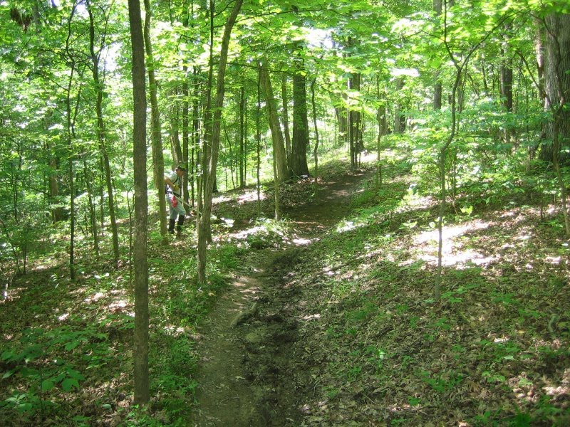
Big Jim Mac and I seized a weekday opportunity to beat the crowds on the OT Curtois section earlier this week. The impromptu "plan" was to explore south from Berryman base camp down to Hazel Creek camp (if possible) for an out n' back trip of about 26 or 27 miles...
...ambitious, no?
The temps were moderate in the low 80's but the humidity was quite high. "High" as in it-started-raining-by-the-end, which made a not insignificant contribution to the overall epic-ness of the ride.
The section from Berryman down to highway 8 was generally similar to the hillier sections of Berryman proper including some babyheads, roots, pea-sized gravel, pine trees, and cool hillside rock formations. The Lost Creek crossing made for a good foot soaking and the sandy run after really put the grindies to our drivetrains. After that the trail generally climbs and descends some cool Ozark topography with a nice variety of lowland riding in lush valleys, and singletrack laced along the hillsides. There were some trees down here and there that killed the flow a little but we removed as many as possible (we were just going to have to ride over them again on the way back anyhow). Jim also spotted some flagging that looked like a re-route or two were in the works for some short steep and/or eroded sections.
In general, the trail surface itself had more duff and organic material on it than most of the trails that get heavier bike traffic but it was all quite rideable, just a bit slower and softer. Many of the hollows and north-facing slopes had awesome moss-covered rock outcrops and ferns lining the trail.

Progress was pretty slow overall, mostly because I was having persistent front tire trouble. I even violated one of basic mountain biking's more simple tenets: thou shalt always check thine tyre for offending objects before installing a new tube... lest ye pop it straight away. It was looking like it was going to be a pretty long ride either way so we turned around at Snapps Branch, about 2 miles shy of our original destination (not to mention one moderate hill + one huge hill, both to be repeated after reversing at Hazel Creek). It's a neat little stream that trickles over a nearly uniform rock surface.

Horses had been through the few miles leading to and from our turnaround spot and the chewed up trail surface made for some more slow going. It was kind of a bummer that I'd slowed us up so much that we fell short of the campground we were both curious to see, but it does leave me with an additional reason to make the drive to ride the rest of that OT section in the future. And even with a popped air mat, a headlamp that croaked in the night, a rainfly that self destructed into a sticky silicone mess, a dented downtube, multiple flats, grindy drivetrains, leg cramps, falling completely over into some manky sludge puddle, and rain on the ride back... I would definitely head back to get some more OT.
Creve Coeur Workday-- Sat., Sept. 18th, 9am-1pm

The Fall workday season kicks off this Saturday on the Bootlegger's Run Trail, at Creve Coeur Park. It wasn't so long ago that this trail didn't even exist, and now there are 3.25 miles of singletrack right in the middle of everything.
Come out and help do some maintenance to ensure that the trail remains in great shape for years to come. Details and sign-up are on the message board.
Fall/Early Winter 2010 Workday Schedule

September is here already and so is the workday season. With a mix of maintenance, and new trail construction there's a lot to be done, so mark your calendar. More information on each workday can be found here as the date approaches.
Sept 18 Creve Coeur Park
Sept 25 Greensfelder Park
Oct 2 Lost Valley
Oct 16 Chubb
Oct 17 North Trace Sawyer Run
Oct 30 Cliff Cave | Appreciation Party
Nov 6 Greensfelder Park
Nov 13 SIUE (Southern Illinois University – Edwardsville)
Nov 20 Rock Hollow
Dec 4 Matson Hill Park
Dec 11 Matson Hill Park
Time Lapse on the Continental Divide


In this case the time lapse is 5 years, which is the difference between when these two photos were taken. The one on the top is from the top of Paywell Mtn. It was taken a few weeks ago, and it's looking north toward the western portal of the Alpine Tunnel.
The lower photo is looking south at Paywell Mtn. taken in 2005 from above the Alpine Tunnel, which sits squarely on the Continental Divide. You can see the turntable where the locomotives were turned around in the lower right. If you look really close, you can see Durango Doug standing right next to the turntable. I can't tell if he has his shirt on.
Matson map updated

Well, it was a little slow in arriving, but the map of the new trail at Matson Hill is finally here! The best thing to report is the current distance of 4.9 miles, up from 2.8. There's a lot more to come, and Matson has 2 workdays scheduled for this year, so come out and help add even more trail. The pdf version of the map should be up on the GORC Trails page soon, and you will be able to find it here.
Withered and melted on MiddleFork
I managed to convince a few foolhardy souls to make an attempt at an out-n-back of Middlefork on the 19th of July. The heat seemed like it might become an issue (heat indices well into the 100's F) but some extra measures were taken by the group to stave off instant death by dehydration or melting: electrolyte tabs, a water filter for refilling bottles and bladders, and I personally went for the full-on, double CamelBak maneuver...

The trail was in pretty good shape and its signature sustained benchcut downhills were as awesome as always. There was quite a bit of thorny veg to force your way through which made for some bloody raw arms and legs.
We hit Barton Fen and took a break... I think my tires were starting to smolder anyway. After refilling some bottles and plotting our next move, the smart guy in the group suggested perhaps a little turn-around-and-start-backing might be in order for safety's sake... because it was unbelievably hot and all. I'm not naming names, but his name starts with "C" and ends with "-raig"... And I'd probably be a dessicated pile of withered, leathery flesh on the side of the trail if I hadn't listened to his good sense.

Summary of Spring 2010 Work

"Car Door Loop" at Matson

More new singletrack at Matson
Another busy Spring. Our trail mileage was down due to the number of workdays that had to be devoted to maintenance. Next time you're out in marginal conditions trying to decide whether or not to ride, please remember that these maintenance days take away from building new trail. Here's a brief summary which lists the trail name, what type of work was done, the number of workdays, and the mileage of the sections worked on:
Cliff Cave - New Construction/Reroutes 1.5 workdays 0.5 miles
Matson Hill - New Construction/Reroutes 4 workdays 1.50 miles
SIUE - Maintenance/Reroutes 1 workday 0.10 miles
Castlewood - New Construction/Reroutes 2 workdays 0.40 miles
Chubb - Maintenance/Reroutes No official workdays 0.10 miles
Greensfelder - New Construction/Reroutes 2 workdays 1.0 miles
Creve Coeur - New Construction 2 workdays 1.0 miles
Matson Hill - June 5th Workday 9-1pm

When: Saturday, June 5th, 2010. From 9:00~1:00.
What: We're having the last of four workdays this spring at Matson Hill Park, and everyone is invited. Mountain bikers, hikers, and trail runners are all welcome, so don’t be bashful about showing up.
This is the continuation of a multi-year project, and we hope to TRIPLE OR QUADRUPLE the current trail mileage at Matson by the time we’re finished.
Where:
From the Highway 40/94 interchange,
• Take Highway 94 South for 7.4 miles to F (turn right on F).
• Stay on F for 3 miles, then turn left on Stub Road. Follow Stub Road for ~.5 miles to gate, and follow directions from there. Or,
• Click this for a Google map link. Clicking the green bike will give you the “get directions” link. (For some reason, the last instruction just has you turning left off of F, without naming the road. That's Stub Road.)
What to bring: Gloves, Sturdy shoes, eye protection, and something to drink on the trail. It’s also a good idea to read through pilznr’s “What to expect at a workday” post, available via this link; http://gorctrails.com/board/topic.asp?TOPIC_ID=3711
Why: To add more multi-use single track (natural surface) trail to the existing Matson loop. This is Phase One of a multi phase project, eventually utilizing 400+ acres of new Park property.
Please RSVP via ONE of the following (to make sure we bring enough food):
• The St. Charles County Park's (SCCP) office [636-949-7535],
• through the WebTrac registration system on the parks website, http://parks.sccmo.org/parks/
• or on this thread.
GORC & St. Charles County Parks will provide: Trail building tools, instructions on trail building, safety guidelines, and lunch.
Bring your bike or trail shoes if you want to try what you built after lunch.
NOTICE: In case of bad weather, please call the St. Charles County Parks (SCCP's) Trail Hotline (636-949-7475, option #2). SCCP's will only leave a message about the workday if it's cancelled.
Monthly Meeting for June- Canceled
The regular monthly meeting scheduled for June 2nd has been canceled. See you on July 7th.
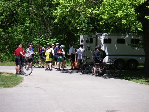
Police Chaser

From May 1-8 the International Police Mountain Bike Association held their annual conference in Chesterfield. Part of their training involved getting some off-road saddle time at nearby Castlewood state park. GORC supplied some volunteer trail guides to help direct the IPMBA participants to trails appropriate for their skill level and, of course, to keep them from getting lost... or arrested or something.
In the above photo Craig Seibert demonstrates how to use your focused chi energy to snap standard police issue handcuffs.
Mike Dunston found and posted this STLToday vid to the GORC forum...
...there aren't any GORCsters in the vid but it's got skid stops and gunfire.
Besides Seibert, the other GORC helpers were Ryan Overhoff, Fred Williams, Greg Suter, Charles Wells, Scott Nelson and maybe one other dude. GORC chieftain Bryan Adams posted this appreciation letter he received on the forum...
I tried to limit myself to just a few doughnut jokes in an effort to not besmirch the club's good name... and not get shot.
The bulk of my other photos from the event are largely based around the incredulity of a horse trailer jammed full of bikes.
Clif Bar Grant Purchase In Action

Last year we received a $500 grant from Clif Bar to purchase a Stihl Yard Boss. I'd seen Glenn using it at workdays at Lost Valley, Creve Coeur and Greensfelder, but those were all on relatively small sections.
Here, we took it out to the Dogwood trail, and used it to remove a large berm that was causing water to be channeled straight down the trail.
This section was about 60' long, and Glenn ripped through it in a little over an hour. It probably would have taken the two of us most of the day to do it by hand. In these pictures, he's around half-way done, and you can see the height of the berm next to the mud. The Yard Boss is a pretty slick little machine, and we're planning to use it even more to help with maintenance and trail building.
Ticked Off


Last year, after one of our members came down with erlichiosis from an encounter with some ticks on the Ozark Trail, I decided to find out some more information about ticks and the consequences of their bites. Luckily for us, we have a tick expert right here in Missouri, who also happens to be a mountain biker- Dr. Greg Cummins, who is a member of Earthriders out in Kansas City, and the author of the Tick-Borne Diseases section of Wilderness Medicine, which is kind of the bible for outdoor medical care. I contacted Greg and had a discussion with him about ticks and the local environment. Fortunately for me, he also mentioned that he would be working on a paper after many years of threatening to do so. So, I managed to win the battle of procrastination, and Greg has kindly allowed us to republish an article that originally appeared on the Earthriders website. He asked me to point out that while the article was written for the KC area, everything in it also applies to the STL as well. I've lightly edited out a few things that didn't really relate to mountain biking.
Despite our nicely groomed and well maintained trails, ticks are abundant at all trails, especially those around the Kansas City metro area. Tick-borne diseases affect everyone, not just those involved in outdoor activities. Building and maintaining trails especially exposes trail workers, as we are working directly in the leaf litter, where the ticks are found. Activities such as walking, working in the yard, sitting out on the patio, in addition to true outdoor sports expose you to ticks and the diseases they carry. Tick-borne diseases are common among us bikers, but are even seen in people who seldom or never go outdoors. They are much more prevalent in those who do spend a lot of time outdoors. Certain tick-borne diseases are five times more likely in pet owners, as they participate in activities more likely to expose the pet owners, and due to pets coming in and out of the residence. This may expose pet and homeowners to tick-borne diseases without actually encountering the outdoors. Ticks are generally non-preferential in regards to a host. In other words, they will get a blood meal wherever they can. Basically, they are not selective, and they suck.
Tick-borne diseases have increased significantly over the past 20 years, for various reasons, from increased suburbanization, increased reservoir host populations (such as deer, raccoons, opossums, coyotes, and numerous others--not to mention the all elusive bobcat or mountain lion), and the increase of people participating in outdoor activities and pet ownership. Additionally, there has been an extension of the warmer seasons, and overall change in weather patterns—call it global warming or climate change, whatever you want, it is indeed happening. Deer populations have increased 60 fold in the past 100 years due to decreased natural predators. Each deer can carry over 3000 ticks. Each female tick may lay over 3000 eggs. Deer are thus a significant contributor to tick populations. Combine these statistics with the increased suburbanization, and Houston, we have a problem.
Tick-borne diseases are often very hard to diagnose. They frequently mimic nonspecific summer flu or viral symptoms, such as general lack of energy, fatigue, headache, fevers, chills, body aches, dry cough, nausea and other gastrointestinal symptoms, among many other vague symptoms. If you experience any of these symptoms, with or without a rash, and with or without a confirmed tick bite, during warmer months (can occur any time of year, but typically March through November), go see your doctor. Doctors are becoming more aware of tick-borne diseases and can treat you and test for these diseases. Basic lab tests which are returned very quickly will indicate specific abnormalities consistent with some tick-borne diseases. Specific immunological tests for most of these diseases are available, though are often inaccurate and take some time to get results. If your doctor is really suspicious for a tick-borne disease, you should start antibiotics immediately.
The main tick-borne diseases to be aware of in this area include (in order of prevalence), with referral websites to CDC links for more information:
Ehrlichiosis (and anaplasmosis), also called the “spotless spotted fevers”—transmitted by 2-3 tick species, is the most common tick-borne disease found in this area. This disease is much like Rocky Mountain Spotted Fever (RMSF), and manifests with high grade fevers, and the above symptoms. The fevers in Ehrlichiosis are often in the 102-104 degrees Fahrenheit range. Twenty percent of adults may have a fine diffuse rash (meaning 80% DON’T have a rash), and up to 40% of children may have the rash. The incubation period for Ehrlichiosis is 3 days to 3 weeks, with a median incubation period of about 7 days. Ticks that transmit Ehrlichiosis typically need to be attached (feeding on you) 24-48 hours to transmit this disease. Untreated, Ehrlichiosis carries a 5% mortality rate, while 30-40% of patients will require hospitalization, so if you ride/work/run/walk on trails around here, see a doctor if you have any of the above symptoms. For more information go to http://www.cdc.gov/ticks/diseases/ehrlichiosis/ and http://www.cdc.gov/ticks/diseases/anaplasmosis/faq.html
Rocky Mountain spotted fever (RMSF) is very similar to Ehrlichiosis in signs and symptoms. The name is a misnomer, as >85% of the cases are from states east of the Rocky Mountains. We do see some around the KC metro area, though far less than Ehrlichiosis. It is also called “black measles” due to the black pimple/crater-like formations often seen. Typically also high grade fevers, >102 degrees Fahrenheit. RMSF is transmitted by various tick species. The incubation period, from time of tick attachment to disease manifestation is 2 days to 2 weeks. The ticks that transmit this disease only need to be attached (feeding on you) for 6 hours for disease transmission to occur. Mortality is 3-5% treated, 20-30% untreated, so don’t mess around with this one either.
For more information go to http://www.cdc.gov/ticks/diseases/rocky ... r/faq.html
Lyme disease, as it is traditionally known, does not exist around here. There is a very close cousin to Lyme disease in the Midwest. True Lyme does exist just north of us, in the Wisconsin/Minnesota/Michigan area, as well as the northeastern US, and extreme western US. We do have Lyme-like disease around here. It is Southeastern Tick-Associated Rash Illness (STARI), as coined by the Centers for Disease Control (CDC). It has some of the symptoms of Lyme disease, but appears to be more self-limited and less severe in its presentation. Patients who apparently have STARI may present with a rash similar to the typical “Bulls-eye” rash seen in traditional Lyme disease. This is a newly discovered disease, but with appropriate treatment, there is no evidence of the long-term ramifications of true Lyme disease. Additionally, there are several websites and clinics dedicated to “Chronic” Lyme disease. In New England, these may be more appropriate, but in our geographic region, true Lyme disease does not exist, and thus there is no “Chronic” Lyme disease in this area. We are still learning a lot about STARI though.
For more information go to http://www.cdc.gov/ncidod/dvbid/stari/ and
http://www.cdc.gov/ncidod/dvbid/lyme/index.htm
There are a plethora of other tick-borne diseases, though the above are the main ones you may encounter in this area. If you travel much, either nationally or internationally, or spend much time hiking or camping, you will need to be aware of many other tick-borne diseases. Many of these diseases are specific to a certain region or environment. Make sure your doctor knows where you have been on recent trips if you have any unexplained symptoms and may have been exposed to any tick-borne diseases. And remember, travel exposure may not be in the traditional sense. Over 29 foreign tick species have been brought into the United States on imported reptiles legally brought into this country. These ticks may transmit a multitude of diseases not normally found nor expected in this area.
What can you do to reduce ticks and transmission of tick-borne diseases??
Do not let these facts scare you away from the outdoors—more of us should participate in and enjoy outdoor activities. Take preventive measures to decrease the chance of disease transmission. Wear light colored clothing, as it is easier to see ticks and remove them before they attach and begin to feed. Check yourself frequently and remove any moving or attached ticks immediately (see below for removal methods for attached ticks). Use a mirror to check those hard to see/reach places, or recruit someone to do this for you. Monitor for the above signs and symptoms if you notice an attached tick, and note the time of exposure/attachment of the tick and removal of the tick, and onset of symptoms. There is absolutely no need to simply start antibiotics for a uncomplicated tick bite (unless you are pregnant—if so, see your doctor right away). Go to your doctor as soon as you experience any of the above symptoms and give them a good history and timeline of events. I am personally not a huge fan of chemicals, though insect sprays containing near or equal to 100% DEET are good deterrents for ticks. Any less than 33% regular DEET will not deter ticks. Do not use high conentrations of DEET on children. A product called Permanone, or other permethrin containing tickicide is great for killing ticks. However, it is a skin irritant and is NOT to be used on, nor allowed to contact, skin, nor use for children. It will remain on clothing or fabrics through several washings at high enough concentrations to kill ticks. The fancy-dancy outdoor places like Cabela’s and Bass Pro Shops, as well as the internet, sell permethrin permeated clothing (www.exofficio.com; http://www.insectshield.com/AboutUs/BrandPartners.aspx, www.insectrepellentwear.com, and www.orvis.com) are a few.
Most tick-borne diseases are easily treated with oral antibiotics, and rarely ever need intravenous antibiotics. If you find a doctor wanting to start you on intravenous antibiotics, and you are aware of this, and not physically in the Intensive Care Unit, find another doctor. There are a few fraudulent “Lyme docs” out there. Most patients do very well with oral treatment, with early recognition. The key, however, is early recognition and treatment of these diseases.
How do I remove ticks once they’re on me??
For free ranging/non-attached ticks, simply pick them off and discard them (i.e., throw them out the window when going 60 MPH—they may bother somebody else, but not you), place them in a bottle with a lid, and dispose of them in the recycle bin, put them in a bottle of alcohol for morbid collection purposes, etc.
For larvae (seed ticks—less than 1mm in size), get some duct tape, and place on your skin where the ticks are (there can be hundreds or thousands of these) and simply peel them off. Another method is to scrape them off with a credit card/bank card, drivers license, etc. These ticks are TINY and have even tinier mouth parts, which only go into your skin a few microns.
For larger ticks (nymphs—the equivalent of juvenile delinquents, or adult ticks), follow the recommendations on the next page. Fancy tick removal tools exist, again, at the same stores mentioned above, but plain old tweezers work just as well, and cost way less. Keep one in your bike bag, or vehicle.
Safe tick removal method:
Gently grasp the tick close to the skin with fine forceps and gently and steadily retract backwards. This will reduce the chance of the tick to leave mouth parts in your skin, and will minimize disease transmission. Clean the area afterwards with alcohol and/or hydrogen peroxide, then cover and keep clean. Observe the area for any signs of infection, and if any redness occurs more than a few days after the tick removal/bite, see your doctor. You can get a local infection, as ticks do not use alcohol wipes to clean the area before they bite. If you get a local redness within a few days at the bite site, that itches a lot, it is a local reaction to the tick proteins they secrete to thin your blood and stay on. It should resolve within a few days. If not, see your doctor.
Also see: http://www.cdc.gov/ticks/tick_removal.html
DO NOT USE methods such as hot matches, Vaseline, alcohol, etc., and do not “snatch” the tick off. Use gentle steady traction straight out, in line with the ticks mouth parts. Place the tick in a bottle of alcohol, and label it with the date and time of removal and where it was found in case tick identification is needed for disease confirmation.
For questions regarding ticks and for tick identification, feel free to contact me via email. While I can not give you direct medical advice, I can help your physician identify ticks, and can help point you in the right direction for a physician if you do not already have one, or a local infectious disease specialist if needed, for more intensive review.
drgacummins(AT)gmail(DoT)com
Greensfelder Figure 9 Epic


Ok, so it's not a Figure 9, and it's not exactly an epic-- yet. Give us some more time on that part. Nevertheless, you can now get in a ride right in your own backyard that until recently, would have had you driving a fairly long way.
There's less than a week until the Greensfelder Challenge Race on May 8th, when we'll finally get to showcase the hard work that's gone into reroutes, maintenance, and brand new trail on the Dogwood, DeClue, and Eagle Valley trails. If that's not enough, all of the proceeds from the race are generously being donated to GORC!
GORC is having a big party at the race, and you're invited. Even if you don't want to race, come on out and ride the trails, and see what's new. Not interested in doing loops on the race course? You can get in a ride of ~18 miles (of which 1.25 is doubletrack and pavement) that makes use of all of the singletrack GORC has built, and doesn't include the same trail in the same direction. You can get the map here.
The short overview is:
- Begin at the Roundhouse main parking lot
- Dogwood
- DeClue CCW
- Deer Run down to Eagle Valley
- Left on Eagle Valley to new singletrack- up to Visitor Center
- Left on bridle path to Scenic Loop
- Scenic Loop back to DeClue
- Declue and Dogwood in the opposite direction that you did earlier.
We had hoped to include the singletrack on Eagle Valley in the race course, but it's not quite ready for prime time. The lower leg up the first switchback will require some dismounts at several swampy spots, but we're hoping to fix them in the near future. The upper leg is in great shape.
There are big plans for more trails at Greensfelder, so come out on race day, and ride, have some fun, and see how you can get involved. The more people we have at workdays, the faster we can get new trail built!
Creve Coeur Workday- Saturday, May 1st
Creve Coeur Lake Memorial Park, Bootlegger’s Run Trail Extension
What: Help continue trail construction that will extend the Bootlegger’s Run Trail along the hillsides overlooking the lake.
When: Saturday, May 1st From 9am - 1pm (FREE LUNCH!) – if dry - Bike or Hike After !
Where: Upper Creve Coeur Lake Park (Entrance off Dorsett Rd - Follow Signs to the meeting area at the North end of the park).
What to bring: Gloves, Sturdy shoes, eye protection, and something to drink on the trail.
GORC & St. Louis County Parks provide: Trail building tools, instructions on trail building, and safety guidelines.
Please contact Sue Kuhnert at 314-615-8822 or email skuhnert@stlouisco.com if you plan to attend.
Volunteers will be rewarded with give-a-ways from Alpine Shop and lunch and breakfast snacks will be provided by St. Louis County Parks.
Update (4-28): It's Wednesday, and there are only 2 people signed up to attend on the message board. If you can spare the time, please come out and help.
Castlewood Workday- Saturday, April 24th
Alright everyone, LISTEN UP!!!
On Saturday, April 24th we will continue the work on one of our favorite but most neglected trails. The Cedar Bluff Trail at Castlewood is in dire need of our helping hands. An 1800+ foot re-route has been started to begin restoring this trail to its former greatness. The initial workday last month set a great foundation but we need to get this re- route done! With a good number of volunteers, we can see this re- route gets completed and opened up. Lone Wolf Coffee Company will be providing an excellent lunch for all volunteers.
Details? From 9:00 am till 1:00 pm on Saturday, April 24th. Meet at the Sherman Beach Trailhead off St. Paul Road in Sherman, MO.
Directions? Sherman Beach Trailhead is located off St. Paul Road in Sherman, MO. From Big Bend Rd. and 141 take the following:
Big Bend Rd. west to New Ballwin Rd.
Take a left onto New Ballwin Rd.
Turn right onto Kiefer Creek Rd.
Turn left onto St. Paul Rd.
Follow St. Paul Rd to Sherman Beach Trailhead on the left
What to Bring? You’ll need gloves, eye protection, water, and protective clothing (there are ticks).
RSVP? Lunch will be provided by Lone Wolf Coffee Company following the workday. Make sure you let us know if you will be attending by posting on this thread.
What is Provided? GORC will supply trail building tools, safety instructions on the tool usage, instructions on how to build and maintain trails, and Lone Wolf Coffee Company will be providing a great lunch.
Why? Cedar Bluff Trail has been subject to abnormally high amounts of erosion over the last several years and its time it gets a little attention. This re-route will provide a more sustainable, enjoyable piece of trail.
After the Workday? Chow down on the great lunch provided and then, trail conditions permitting, ride!
Lone Wolf Coffee Company: www.lonewolfcoffeecompany.com
More Greensfelder Fun
Craig working on armoring

Finished Section
We spent this past Saturday finishing off the addition of a brand new 3/4 mile section of the DeClue trail (thanks Americorps!), armoring some muddy problem spots, and deberming a long stretch of trail. Most of this was done in preparation for the Greensfelder Challenge Race on May 8th. All of the proceeds from this race will go to GORC.
Everyone involved in the race should be very grateful that we were able to talk Matt out of running the course the way he had originally planned. He kept saying that if he could ride it 32x16 fixed on his rigid 29er that everyone else ought to be able to ride it as well, but cooler heads prevailed, and the majority of the climbing is now on gravel rather than Rockwoods boulder-field. The course is pretty much part of the standard GORC rides out there anyway.
Mr. Seamonkey has reconstituted himself (except for his back which was not properly hydrated apparently), and created a blog dedicated to the race for your enjoyment and enlightenment. Please be sure and answer the poll questions, and provide any feedback you might have. We always like to know what people are thinking!
April 10th, Greensfelder Workday
Greensfelder Workday
April 10th, 2010, 9am to 1pm
Trail Construction
Date: Sat, April 10th, 2010, 9am to 1pm (FREE LUNCH!) – Bike or Hike After!
Location: Greensfelder Park, St. Louis County
What: Help build new trail and do maintenance at Greensfelder Park in preparation for the May 8th Federation of Dirt Greensfelder Challenge. We will be adding 0.7 of a mile of singletrack to the Declue Trail and armoring several drainages.
Where: Greensfelder Park, Allenton Rd. behind Six Flags (Park at Tower Lot)
Take Interstate 44 to the Allenton/Six Flags Exit 261. Go north on Allenton Rd, past the Six Flags entrance. Allenton Rd. bisects Greensfelder Park. Lunch will be afterwards at the Mueckerman Shelter located at the corner of Allenton and Hencken road.
(See www.gorctrails.com for directions and details of the park)
What to bring: Gloves, Sturdy shoes, eye protection, and something to drink on the trail.
Advance registration is required for Saturday. Please contact Sue Kuhnert at 314-615-8822 or email skuhnert@stlouisco.com
GORC & St. Louis County Parks provide: Trail building tools, instructions on trail building, and safety guidelines.
Creve Coeur Workday- Saturday, March 27th
What: Help continue construction that will extend the Bootlegger’s Run Trail along the hillsides overlooking the lake.
When: Saturday, March 27th From 9am - 1pm.
Where: Upper Creve Coeur Lake Park (Entrance off Dorsett Rd - Follow Signs to the meeting area at the North end of the park). (See GORC's Creve Coeur page for directions and details of the park).
What to bring: Gloves, Sturdy shoes, eye protection, and something to drink on the trail.
GORC & St. Louis County Parks provide: Trail building tools, instructions on trail building, and safety guidelines
Signup and more information is available here.
Please contact Sue Kuhnert at 314-615-8822 or email skuhnert@stlouisco.com if you plan to attend.
Volunteers will be rewarded with give-a-ways from Big Shark Bicycle Company with lunch and breakfast snacks provided by St. Louis County Parks. Afterwards, if it's dry, we'll ride the trail that was just built.
Matson Hill Workday- Saturday, March 20th
When: Saturday, March 20th, 2010. From 9:00~1:00.
What: We're having the 1st of four workdays this spring at Matson Hill Park, and everyone is invited. Mountain biker, hikers, and trail runners are all welcome, so don’t be bashful about showing up.
This is the continuation of a multi-year project, and we hope to TRIPLE OR QUADRUPLE the current trail mileage at Matson by the time we’re finished.
Where:
From the Highway 40/94 interchange,
• Take Highway 94 South for 7.4 miles to F (turn right on F).
• Stay on F for 3 miles, then turn left on Stub Road. Follow Stub Road for ~.5 miles to gate, and follow directions from there. Or,
• Click this for a Google map link. Clicking the green bike will give you the “get directions” link. (For some reason, the last instruction just has you turning left off of F, without naming the road. That's Stub Road.)
What to bring: Gloves, Sturdy shoes, eye protection, and something to drink on the trail. It’s also a good idea to read through the “What to expect at a workday” post. Bring your bike or trail shoes if you want to try what you built after lunch.
Why: To add more multi-use single track (natural surface) trail to the existing Matson loop. This is Phase One of a multi phase project, eventually utilizing 400+ acres of new Park property.
Please RSVP via ONE of the following (to make sure we bring enough food):
The St. Charles County Park's (SCCP) office [636-949-7535]; through the WebTrac registration system on the parks website, http://parks.sccmo.org/parks/; or on this thread.
GORC & St. Charles County Parks will provide: Trail building tools, instructions on trail building, safety guidelines, and lunch.
NOTICE: In case of bad weather, please call the St. Charles County Parks (SCCP's) Trail Hotline (636-949-7475, option #2). SCCP's will only leave a message about the workday if it's cancelled.
Castlewood Workday- March 13th
On Saturday, March 13th we will be working on one of our favorite but most neglected trails. The Cedar Bluff Trail at Castlewood is in dire need of our helping hands. An 1800+ foot re-route has been planned to begin restoring this trail to its former greatness. Please, come be a part of this great event that will help keep Cedar Bluff Trail useable for years to come.
Details: From 9:00 am till 1:00 pm on Saturday, March 13th. Meet at the Sherman Beach Trailhead off St. Paul Road in Sherman, MO. Parking may be limited, so carpool as much as possible.
Directions: Sherman Beach Trailhead is located off St. Paul Road in Sherman, MO.
From Big Bend Rd. and 141 take the following:
Big Bend Rd. west to New Ballwin Rd.
Take a left onto New Ballwin Rd. RdTurn right onto Kiefer Creek Rd.
Turn left onto St. Paul Rd.
Follow St. Paul Rd to Sherman Beach Trailhead
For google maps directions, type 1582 st. paul rd, sherman, mo into the search box.
What to Bring: You’ll need gloves, eye protection, water, and warm, protective clothing.
RSVP: Lunch will be provided by Lone Wolf Coffee Company following the workday. Make sure you let us know if you are going to attend. That way we can make sure everyone gets some delicious grub following all the hard work.
What is Provided: GORC will supply trail building tools, safety instructions on the tool usage, and information on how to build and maintain trails.
Why: The Cedar Bluff Trail has been subject to abnormally high amounts of erosion over the last several years and is in need of attention. This re-route will provide a more sustainable, enjoyable piece of trail.
After the Workday: Chow down on the great lunch provided, and then, trail conditions permitting, ride!
SIUE Workday- Saturday, March 6th
When: Saturday, March 6th, 2010. From 9:00~1:00.
What: We are doing some much needed maintenance work at SIUE. The trails received very little TLC last year, so let's get them spruced up for Spring '10.
We will be doing a short re-route around the mudpit on Trail 1, as well.
Why: SIUE is a super popular trail system that gets a lot of use, and is all dirt, so it needs quite a bit of work to keep it truly sustainable.
More Info: Please RSVP via this thread where you can ask questions or find more details.
Directions: From the Highway 40/94 interchange, Take hwy 255 North past Interstate 270, to New Poag Road. Turn Right or East at the end of the exit ramp. Stay on New Poag Road until the first intersection with a 4 way stop sign. This will be University Drive. Turn Right onto University Drive. The road will immediately bend to the left, at the end of the bend on your right is a gravel road, turn onto the gravel road. Follow the rock road past the hedgerow on the left, the road will make a 90 Degree turn to the right and then back to the left, then it will dead end. The Northernmost Trailhead is located at the 90 degree corner of the woods near that dead end.
What to bring: Gloves, Sturdy shoes, eye protection, and something to drink on the trail. It’s also a good idea to read through pilznr’s “What to expect at a workday” post, available via this link.
GORC will provide: Trail building tools, instructions on trail building, safety guidelines, and lunch. There will be giveaways as well. Bring your bike. There will be some sort of a ride afterwards, even if we cannot ride the trails due to conditions. There are miles and miles of bike paths in Madison County for your riding enjoyment if it is too muddy.
Sponsor: The Cyclery is sponsoring this workday and will be providing lunch from Blimpies, some great swag. Stop on by their shop after the workday and say hello. They are good people.
They're located at 2472 Troy Road, Edwardsville, IL 62025 and you can contact them at 618-692-0070, Store Hours: M-F 9-8, Sat 9-5, Sun 12-4.
Greensfelder Workday - Feb. 27th, 9am - 1pm
 Yellow line represents new trail reroute to eliminate fall line at the end of the DeClue trail. Blue is existing DeClue. Trail in Blue after Yellow line intersecton will be reclaimed back to forest. This will be about a .35-.45 mile piece of new singletrack built to IMBA standards.
Date: Sat, Feb 27, 2010, 9am to 1pm
Location: Eureka, MO
Join GORC & St. Louis County Parks at Greensfelder Park on Sat, February 27th, 2010 from 9am to 1pm to help build new trail and re-route sections of existing trail at Greensfelder Park.
We will be re-routing a short steep section at the end of the Declue/Greenrock Trail where it ties into the Scenic Loop road.
Come out, work with us in the morning, we'll serve you a nice lunch, and then we'll bike or hike afterwards.
How to get there: You're headed for Greensfelder Park on Allenton Rd. behind Six Flags. You should park at the Tower Lot. Take Interstate 44 to the Allenton/Six Flags Exit 261. Go north on Allenton Rd, past the Six Flags entrance. Allenton Rd. bisects Greensfelder Park. Lunch will be afterward at the Mueckerman Shelter located at the corner of Allenton and Hencken road.
What to bring: Gloves, Sturdy shoes, eye protection, and something to drink on the trail.
What GORC & St. Louis County Parks provide: Trail building tools, instructions on trail building, and safety guidelines.
Advance registration is required. Also, post on the messageboard if you are attending. Please contact Sue Kuhnert at 314-615-8822 or email skuhnert@stlouisco.com
Cancelled- SIUE Workday- Saturday, February 6th
Straight from Kirby:
I am canceling the workday. Even w/o the snow, the mud on the trails will make it very dangerous to get around with sharp tools. Please pass the word. We will reschedule when it is less dangerous and probably snowy. Watch for it.
I am canceling the workday. Even w/o the snow, the mud on the trails will make it very dangerous to get around with sharp tools. Please pass the word. We will reschedule when it is less dangerous and probably snowy. Watch for it.
Upcoming Events

Jan. 31st- Midwest Bike Expo in Collinsville, IL. GORC will have a booth there where you can find out more info about the latest projects, pick up some literature or maps, or buy some GORC merchandise.
Feb. 3rd- Regular monthly meeting at the Schlafly Tap Room.
Feb. 6th- The trails at SIUE have taken a real beating and need some attention.. We'll be rerouting a section near the asphalt on Trail #1 which has turned into a permanent mudpit, as well as fixing some of the other problem areas that have developed. More info and sign up for the workday.
Feb. 27th- Greensfelder Workday. We're continuing work on the switchbacks which will complete the DeClue extension and carry the trail all the way over to the Scenic Loop Road. Bryan has posted some pictures of the fun involved in getting the rocks down to the site posted on the GORC Facebook Page. We'll also work on getting other areas of the existing trails into riding shape. More details and signup as they become available.
Feb. 28th- The first of St. Charles County Parks Moonlight Ride series will be held at Broemmelsiek Park from 6-9pm. These are organized rides in parks that usually don't permit riding at night, and are always a good time.
Subscribe to:
Posts (Atom)