It's been a great year so far and the weather has played along nicely. While I'm bummed to see the annual GORC vacation come to a close I've gotta say that the riding around St. Louis has been top-notch.
Matson Hill, Castlewood and Greensfelder are all riding fast and maturing gracefully. Greensfelder is especially nice right now. The weather has allowed bikers to keep the horse hooves beat down and there aren't really any hooves to beat down because no one has been riding in the rain. Because it hasn't been raining!
Matson Hill is the sleeper in the metro St. Louis area. Erase all past memories - the newly minted Oxen Mill trail addition is stellar and is the gem of St. Charles county. The GORC trail designers outperformed themselves and I can't wait to see what's coming next.
The best way to meet mountain bikers is to attend mountain biking events and we appear to have stacks of them coming up all put together by solid organizations.
In the race category we have the Matson Hill Mashor race next Sunday (the 6/12 hour SAC River race is the previous day), followed by the Chubb Time Trial in early October. That race is sure to find the weak link in you and your bike.
Next up we have both a festival event out of town - the Brown County Breakdown in Indiana - and a legendary 6/12 hour Missouri race - Burnin' at the Bluff. Both events are not to be missed, however, you'll have to miss one. If you've always wanted to do an endurance race and meet damn near every competitive mountain biker from St. Louis then you owe it to yourself to haul down to Council Bluff Lake. The camping is superb and the comaraderie grows deep into the night. Meanwhile, the Brown County Breakdown is held at the massive Brown County State Park and offers 30 miles of buff, flowy singletrack. Upwards of 700 people attend and you'll be the select few that traversed state lines to attend. This is a great introduction to the STL pilgrimage that is "hey, i'm going to brown county."
If you are into cyclocross then there's a ton of 'cross events scheduled around the STL into early next year. I haven't jumped into that pool so that's all I know about 'cross. I do know I love exploring on my Salsa cross bike, though. If a road bike is like a car then the cross bike is a stylish SUV; fast but always ready to get a little dirty (and its tires won't explode at the first sign of singletrack.)
And don't forget that GORC has a fall calendar FULL of trail workdays where we build and maintain trail in the morning and then get to ride that park's trails in the afternoon. This year we are having our GORC Volunteer Appreciation Day at Creve Coeur park. We'll post more details as the date approaches.
That's enough to keep you busy for the next few months. I am saddened to be back from Taos (so soon it's over?) but our trails are a shining star in the midwestern region and I'm happy to have discovered GORC back in 2001.
Fun fact; my very first workday was at Greensfelder. The workday was hard (worked on a section of Dogwood that's now been rerouted/closed), the trails beat me down, I saw Chewie throw up while climbing on a fixie and my Trek 6500 with flat pedals got scratched up. But I was hooked. Forget Grant's trail!
Last Ride: All Epic - Garcia Park, Jaracita, South Boundary
On the last riding day, GORC headed up to Garcia Park and offered three ride scenarios; Ride from there down South Boundary to town (11 miles); Ride Jaracita as a loop and ending on South Boundary back at Garcia Park (14 miles); or kill it and ride the Jaracita loop and then take South Boundary all the way to town (31 miles).
Half the group rode from the cars to town, though, they made a group decision and detoured onto the Ojito Canyon trail which made their total 18 miles. The other half rode Jaracita loop with Bryan, Ross and Jason leading ahead to also tackle the epic down into town.
However, little did we know, Jaracita's upper reaches was comprised of narrow singletrack/bear track with large stretches of just beaten down grass. It was a truly awesome trail with alpine views and the sense of riding where not many people go - except bears, deer, cows, elk, squirrels and cougars. The riding was generally uphill until we got to South Boundary at which point Jon, Tom, Mari and Steve W saw the black death cloud forming over our descent.
The final GORC ride was, as always, truly epic. Thunder clouds, lightning, heavy rain, coldness and wet electronics, I wasn't going to forget this ride. The descent was sketch, especially without glasses (hey, where are they?) and I forgot about the two mile climb near the cars at Garcia.
The loop riders all got wet. The townies stayed dry and rode the most mileage. It was a great last day in Taos.
 Following a chicken path - it was an adventure that reminded me of the Alpine Tunnel loop.
 Only bent grass indicated the trail in several spots
 The narrowest singletrack of the week. Steve W was in heaven
 Speaking of heaven, New Mexico felt like giving us a good old beat down. A great shot but it all went to hell six minutes later.
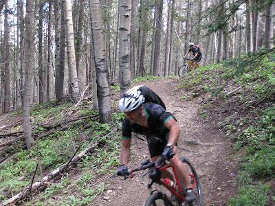
Winded on Winsor; The non-shuttle Ride
Matt, Tom, Lisa and Mari headed down to Santa Fe on Thursday to ride the famed Winsor trail just north of town. The trail drops 3,400 feet in ten miles and consistently drops - no climbing in the middle of the ride.
Since we didn't want to deal with the super long timeframe of shuttling cars back and forth we rode this out'n'back from the base to the top and then dropped back down. It took 3 hours to climb (with numerous camera breaks) and 44 minutes to descend - half of it in a good, pouring rain. The descent was fantastic and the views were super scenic.
The other GORCers rode AngelFire and had the time of their lives. I was torn and wanted to do both but Winsor, again, was a trail I'd been wanting to ride since last year. I'll post up some AngelFire photos when I get their camera images.
Oh, you might want to ask Mike why wearing a helmet is generally a good idea. Never saw anything quite like it...
 The trail begins by climbing between residential properties for the first mile. If you didn't keep pushing you'd swear this trail was anything but beautiful or epic.
 We broke out into this meadow a three miles up the trail and entered the Ponderosa Pine section. The trail base is damp and similar in feel to the Pacific Northwest (weird), enters the Pines, then Aspen and finally, high elevation foliage.
 Many parts of Winsor are in mint condition. Large sections, however, are turning into a downhill course with huge ruts, gaping wide singletrack and general trail cargnage. Since the trail follows the Tesuque drainage, it's tough for it to even come close to IMBA's recommended trail gradients.
 Another section of perfect bench
 The climb was steady and doable until it got stupid steep near the top. The Garmin 800 loaded with a ton of area trail courses was invaluable with the numerous intersections, lack of signage and forest maps not featuring all the trails available.
 Tom near the top of Winsor. It was quickly becoming like a motorcycle hill climb trail.
 The view from the top of Winsor near the Santa Fe Ski and Recreation area. The scenery stretched over 70 miles. Classic mountain bike awesome. Classic.
Rest Day - Tent Rocks For Matt n Lisa
For the rest day, Matt and Lisa headed down to Santa Fe to check out the Tent Rocks National Monument. The rest of the house went white water rafting on the Rio Grande in Taos but I'd been wanting to check out Tent Rocks since last year.
I don't have any photos of the rafting as I haven't acquired everyone's camera photos so the blog is MnL photocentric.
Figured we'd better get some house photos before the trip ends.
 GORC:Taos Basecamp back patio. The hot tub is off to the right. The 7,500 SF house served us well. Across the gravel road we had an Adobe-style 3,000 SF home with a tremendous view of the mountains.
 Blog update in action
 Tent rocks are formed when the softer tuff/volcanic ash is protected by a denser caprock and water over millions of years erodes the material.
 Hiking above the valley of the Tent Rocks
 Classic northern New Mexico landscape. We don't get these kind of vistas in Missouri
Rio Grande Del Rancho and the Green Chili Beer
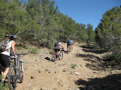
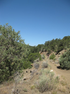
Feeling a little tired today we all decided to ride the much more relaxed out-n-back Rio Grande Del Rancho 12 mile (total) trail. This formerly double-track trail climbed and descended the contours southeast of Rancho de Taos. I say formerly because it is mostly a two-track width of Banshee ATV tracks. The tracks offered a nice berm in all the corners so we could keep our speed. It was a reprieve in preparation for the rest of the week which we are still figuring out.
After the casual ride we all went to Eske's Brewpub and had lunch. We are taking the afternoon off but some may be rafting the Rio Grande tomorrow.
Stay tuned for an update tomorrow. I know it's a brief update but you like looking at the pictures anyway, right? Anyhow, I need a beer.
 As usual, no matter how flat the actual ride, there is always a steep, loose climb at the start!
 Climbing 3 minutes in...
 View from the top where the trail levels off
 The trail is reminiscent of the Midland Trail in Buena Vista, CO
 Craig leaning into the short climb out of the arroyo
 It's hard to imagine the mountains are five minutes outside Taos
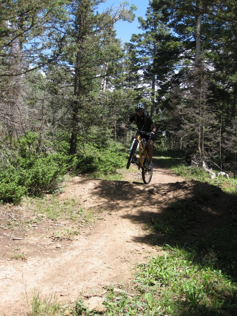
 Stunting the jump
 Steve W jumped the jump and used his shoulder to skid-steer ... and blew the front tire off his rim .. and tweaked his rear rim.
 After the ride we stopped at Eske's brewpub for a sampler. The bottom left is the famed Green Chili beer.
 Green chili stew burrito!
 Marvin eyeballing the goods Matt and Lisa ordered
 All your courtyard are belong to GORC
 Mission accomplished
After the casual ride we all went to Eske's Brewpub and had lunch. We are taking the afternoon off but some may be rafting the Rio Grande tomorrow.
Stay tuned for an update tomorrow. I know it's a brief update but you like looking at the pictures anyway, right? Anyhow, I need a beer.
 As usual, no matter how flat the actual ride, there is always a steep, loose climb at the start!
 Climbing 3 minutes in...
 View from the top where the trail levels off
 The trail is reminiscent of the Midland Trail in Buena Vista, CO
 Craig leaning into the short climb out of the arroyo
 It's hard to imagine the mountains are five minutes outside Taos
 Stunting the jump
 Steve W jumped the jump and used his shoulder to skid-steer ... and blew the front tire off his rim .. and tweaked his rear rim.
 After the ride we stopped at Eske's brewpub for a sampler. The bottom left is the famed Green Chili beer.
 Green chili stew burrito!
 Marvin eyeballing the goods Matt and Lisa ordered
 All your courtyard are belong to GORC
 Mission accomplished
Down the South Boundary
The South Boundary trail is Taos' trail gem. It's the equivalent of going to Salida and riding the Monarch Crest or Durango for Kennebac Pass.
We loaded up the trucks and drove for about an hour up into the mountains where we dropped Jason and Ross off at the Elliot Barker trail to get a longer ride. The South Boundary is right around 20 miles and coupled with Elliot Barker they were looking at about a 34 mile ride.
Once they were dumped off we continued onto a rough dirt road before reaching the trailhead. All the riders unloaded and Suzanne, Mike, Glenn and Karen were all kind enough to take the vehicles to the end of the ride. Had they not our shuttle recovery mission would've added an extra tiring hour to the day.
The South Boundary shot up at a steep but rideable percentage. We climbed an additional 800 feet at the start before topping out at 10,700 feet at the trail's crest. From there it was all generally downhill except for the uphills in the middle.
However, once we passed Garcia Park and climbed a bit more we got to experience an 11 mile downhill more or less. Flying through the aspens it was hard to take in the scenery at times. But - you also don't want your eyes to stray as the mountainside grade sloped away enough to make you pucker.
Eventually South Boundary quit playing nice and dropped 1900 feet in 2.5 miles. This part of the trail traversed the arid lower elevations so large loose rock and outcroppings kept things mighty interesting at speed.
After four hours of downhill bliss, smoked brakes, a bent chain and 'wondering' where Ross and Jason might be we rolled into the parking lot and drank in the scenery.... in a can.
You'll have to ask Jason about the bear in the woods, a guy with a weed eater, getting lost with a gps course and how much he cares for Elliot Barker for the full story.
 Of course no matter how far you drive up there is always a singletrack uphill awaiting at the start
 Steve and Lisa climbing the 800 foot early ascent
 Craig taking a berm
 Beginning to open up into a meadow
 Stopping for a break at Garcia Park in the middle of South Boundary
 Climbing out of Garcia Park and onto the second half of major awesomeness
 Jon A getting above the roller
 Kirby floating
 John T on the descent
 There were several rollers early into the last major descent down South Boundary
 Tom dropping the natural water bar
 As we got closer to Taos the scenery changed from Pines to Aspen to semi-arid pinon and sage
 The last half-mile back to the trucks. What a great day.
Horse Thief and Killer Dinner
We rode Horse Thief yesterday near the Gorge and are heading up to ride the legendary South Boundary trail today. I'll keep this post short but hopefully you can see how the day went with this photo montage.
As always on vacation, I'm running late this morning.
 Loading up to head out
 Groupshot at Horse Thief trailhead - like herding cats on bikes.
 Looking into the canyon at the start of the ride
 Glen heading onto the trail
 Rodney finishing the last climb
 Jon A leading the train
 Bryan on the SuppleFly
 Kirby
Kirby
 Marvin with Steph catching up
 Post-ride reflection with Tom, Mari and Kirby
 Bryan, Matt and Steve looking into the canyon
 Matt, Lisa, Tom and Mari headed to the Taos Pueblo in the late afternoon - simply amazing
 An Indian oven - a horno - where the Indian bread comes from. Oh the Indian bread!
 Matt flash-frying Shishito peppers for everyone. A New Mexico staple.
 Shishito pepper make you crazy, man
 'I can cook burgers!' ...
 '...and burn down the hillside.' Aren't we at Stage II fire restrictions?
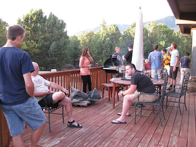 Enjoying the fantastic New Mexican evening weather at million dollar house.
Subscribe to:
Posts (Atom)