Field Test-- Fanno Bull Saw
I don't know what's nerdier, using a hand saw to cut out deadfall, or writing an article about it. Anyway, most people probably never give much thought to how those trees laying across the trail magically disappear. There are several ways: trail users remove smaller ones that can be moved by one or more people, or cut with a pack saw; staff in many parks remove them once they are notified of the location; or GORC sawyers, with the park's permission, cut them out. There are 5 or 6 active sawyers right now, so the same guys keep getting called on.
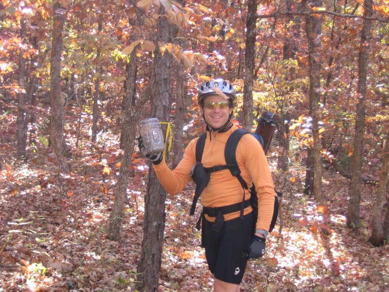
After spending a long evening recently dealing with Stinkbait's finicky Poulan to remove a couple of trees on Dogwood and DeClue, I decided chainsaws were a real pain. Not having any desire to own one, got me looking for alternatives, and I came across the Fanno Bull Saw, which is billed as a one-man crosscut saw.
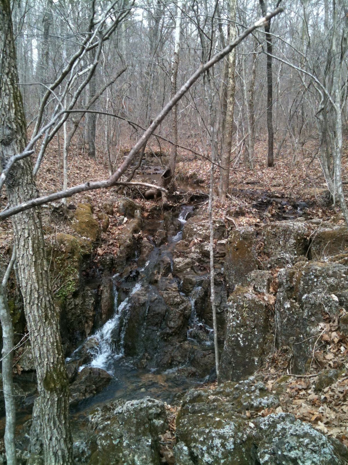
I figured that if I could cut out these trees on Deer Run shown in the pictures, I could probably do anything because:
--the tree was green
--the crown was caught up in another tree putting it in compression
--the diameter was ~10-14"
-- the tree was high off the ground and couldn't be supported it until it got lower
--it was hot
--my assistant had a short attention span
To make a short story short, it took about 45 minutes to make 4+ cuts. I think it would have been much faster had I used wedges, and all of the above stuff hadn't been against me. A chainsaw would have probably been done with everything in about 10 minutes or less, assuming everything went as expected. Overall, the time getting ready + time spent cutting probably balanced out.
Summary:
This saw works pretty smoothly, but was certainly more work than a chainsaw. The good things: much smaller investment; no time loading up bob-trailer and necessary equipment; no need for all the chainsaw safety equipment (chaps, earplugs); quiet, no smelly exhaust. I'll use it again for uncomplicated ones, but will probably leave the more difficult ones for a chainsaw.
Edit 3/30/11: Since I wrote the original post last fall, I've used the saw again at Greensfelder and SIUE. It really makes pretty quick work of trees up to about 10", and usually only takes a short time to get through, depending on how fit I am at the time... I've run into a few problems with trees that were lying flat on the ground, but as long as they're elevated enough to get the saw underneath as well, it hasn't been that big a deal.
Indian Camp Creek Workday- Saturday, March 26th 9am-1pm
When: Saturday, March 26th, from 9:00 til 1:00.
Where: Indian Camp Creek Park. It's approx 7 miles North of I-70 on 40/61. (Turn left on Dietrich Rd roughly .6 miles after passing W.) The Google Map link (click this for link, then click the Green bike) will take you to the Park. Follow the road around to the back of the Park, and look for signage that will direct you to Saturday's meeting location. (This'll have to do until Google updates their map from early 2006. )
What to bring: Gloves, Sturdy shoes, eye protection, and something to drink on the trail. Please read through pilznr’s “What to expect at a workday” post. It will also give you some hints on how to prepare for a workday.
Please RSVP via ONE of the following (to make sure we bring enough food):
The St. Charles County Park's (SCCP) office [636-949-7535],
through the WebTrac registration system on the parks website, or on this thread.
GORC & St. Charles County Parks will provide: Trail building tools, instructions on trail building, safety guidelines, and lunch.
NOTICE: In case of bad weather, please call the St. Charles County Parks (SCCP's) Trail Hotline (636-949-7475, option #2). SCCP's will only leave a message about the workday if it's canceled.
We've got ~ 40 Scouts and their parents coming out, so we could use some experienced workers. There's a reroute, plus a couple armoring projects on the list of things to do, so we've got something for everyone.
Lunch will be provided by Off The Front, so thank one of the team riders the next time you see them on the trails.
Don't forget this is another chance to enter the 2011 GORC Workday Season Raffle for a GT Peace 9r!
Labels:
2011,
indian camp creek,
singletrack,
spring,
workday
Ride Report: On the Middle Fork in the Middle of March
Lisa and I rode the Middle Fork Saturday in an effort to purge some early season non-riding weaknesses such as ... non-riding. Being that Ouachita is two weeks away or something it seemed wise to at least see if we could competently ride half of it by running the 'Middle Fork-xc loop' implemented by the Team Seagal troops.
Stats (mfxc loop version):
+31 miles total broken down as / 18.5 singletrack (part I) / 10 miles gravel (part II) / 2.5 miles singletrack (part III - you re-ride the first singletrack segment back to the trailhead)
+ 3,200 ft elevation more or less
+ guaranteed awesome trail or your money back
+ seems to be dry when you assume it would be wet like everything in metro STL
+ your feet will get wet at Barton Fen and thereafter
There is a longer full loop that takes you to the end of the Middle Fork section but I have yet to ride it. That loop would make the mileage top out at 38, the extra 7 evenly split between trail and gravel/road.
There's water running down the first major falls. Camping can be had just across the mini-gorge. It's an interesting geological oddity because the terrain near the creek drainage breaks away revealing the water cut rock and opens into an expansive, but relatively shallow valley.
Burning sensation: The forestry service is currently burning 4,000 acres in the area and riding through this large patch on the Middle Fork is both alien and awesome at the same time. It's cool to easily see the singletrack flow ahead on the contours.
The Middle Fork section of the Ozark Trail is the newest segment to be built within the last eight years. Since its opening in 2005, the trail has grown close to the hearts of mountain bikers and hikers with terrific views, geological features, creeks and sustainable, lengthy climbs and descents. This trail allows contiguous access to North Trace/South Trace, Council Bluff and the Berryman Trail. You could destroy your bike and body before you rode everything offered at the corner of HWY 32 and DD.
Ride it and love it.
The Middle Fork section is to be renamed in honor of the Ozark Trail Association founder and volunteer, John Roth who passed away far too early, for his dedication to the Ozark Trail. Without his leadership and planning, the Middle Fork section would not have been possible. This section was completed in November of 2005 making the Ozark Trail the longest multi-use trail in Missouri. The Middle Fork section connects with the Trace Creek section just northeast of Highway 32 and runs south to the Karkaghne section at Highway J.
Stats (mfxc loop version):
+31 miles total broken down as / 18.5 singletrack (part I) / 10 miles gravel (part II) / 2.5 miles singletrack (part III - you re-ride the first singletrack segment back to the trailhead)
+ 3,200 ft elevation more or less
+ guaranteed awesome trail or your money back
+ seems to be dry when you assume it would be wet like everything in metro STL
+ your feet will get wet at Barton Fen and thereafter
There is a longer full loop that takes you to the end of the Middle Fork section but I have yet to ride it. That loop would make the mileage top out at 38, the extra 7 evenly split between trail and gravel/road.


Ride it and love it.
The Middle Fork section is to be renamed in honor of the Ozark Trail Association founder and volunteer, John Roth who passed away far too early, for his dedication to the Ozark Trail. Without his leadership and planning, the Middle Fork section would not have been possible. This section was completed in November of 2005 making the Ozark Trail the longest multi-use trail in Missouri. The Middle Fork section connects with the Trace Creek section just northeast of Highway 32 and runs south to the Karkaghne section at Highway J.
Wet-Weather Adventure I: When Ya Gotta Go, Ya Gotta Go: Taking a Dump on the Trail
In late February the thaw and wet weather cycle forced me to ride my road and cross bikes more than I desired but here I was, forced yet again to get some 'long-steady-miles' whether I wanted them or not.
Let's start by showing you what I wouldn't see on this trip...
That's the Greensfelder, for the record. Not anywhere close to the location of this episode.
With a goal of 50 miles on a early Thursday or Tuesday afternoon - I don't know - the wind carried me down into a Soulard preparing for Mardi Gras. Hookers at Johnny's set up tents and frat truckers quaffed Bud Light Lime.
Skipping 7th Street, I headed North on 3rd St. - the hell of the East. Broken and severely buckled pavement kept me alert while a headwind increased its volume. Shooting past the Arch, skimming by Hopeville, I settled into a nice rhythmn. I waved to the Hazmat crew that has been diligently working at the radioactive site between the trail and river bank for the past two weeks. I know it's radioactive because they have the radiation symbol... and the guys are in white suits. And big wigs seem to be watching from massive F-350s at all times. This is news that will never make it to air.
Anyway, I said I settled in, right? I did for about 15 minutes until I glimpsed a green minivan rounding just out of site. The flood wall curved to his benefit.
Normally, this is just what we call traffic on the Riverfront bike trail. Fish traffic, heavy machinery traffic, crack traffic, whores-for-crack traffic, rush hour overflow traffic, the trail sees it all.
I found out this was traffic fell under the dumping category.
On top of the levee just past the homes on barges, just far enough ahead the driver kept starting and stopping, obviously trying to set some distance between us. I looked down, grabbed some water and stopped to look at the supreme massive crane at the Alberici yard that must be building the piece parts for the oil refinery up the river.
Well, holy crap, I look up the trail after resuming a steady pace and I see the guy dumping his entire van out on either side of the trail.
Like a small apartment amount.
I rode up to the van and glanced over to him while he sat inside. Smoking a cigarette and looking directly at me, I'm pretty sure he questioned the 'hassle' it would be to throw me in the river.
I think it was going to be too much work.
I rode swiftly on, hoping that he didn't want to ask for directions to the nearest license center so he could get his plates renewed. When I turned around for a look, he has making a U on the levee and headed back to who knows where.
Story Shrink: ..., rode up to the Chain of Rocks, rode past 270 to Columbia Bottoms to check out the Confluence. Checked it out and headed back the way I came, past the Chain of Rocks, past the pimped out Mexican truck with every stick-on accessory AutoZone sold (stick on air scoops??) Rode past some abandoned cycling clothes and helmet by the creek drainage (la la la, I'm not thinking about what happened - they got hot ... and ran the other way.)
Came back upon the mini-landfill and attempted to find out 'who' this guy was so I could turn the info in.

I didn't know this was a new landfill. Otherwise, I would've pulled the BOB trailer with the ground plastic and leachate cleaning system. Now it's just going to drain into the river.
It's not in the picture but there's a box of canned food right over there. Corn, spinach, Chef Boyardee, Rice, Cupcakes (open), all with a light sheen of fry grease on the tops.
He has it on blu-ray now.
Because this is a public site with standards of sorts, I am self-censored from showing the pile of wicky-wicky tapes.
I did find several denied unemployment claim statements that had the same name on it. Riding on for about two miles I saw another vehicle approaching. ugh.
Miraculously, it was a CONSERVATION truck. The female agent took the letter and I told her all I knew. Of course, she asked for details. "Uh, green minivan, don't know the plates, black guy, smokin' a cigarette, didn't stop to ask." Case closed, unfortunately.

The story sounds like it should end bad. But that's just not true. Whenever you get on your bike, if you look around, you can best be assured there is an adventure somewhere looking to stir your interest... or drag you into the river.
Until next time, remember kids, recycle all you can and give the rest to the san man.
Let's start by showing you what I wouldn't see on this trip...

With a goal of 50 miles on a early Thursday or Tuesday afternoon - I don't know - the wind carried me down into a Soulard preparing for Mardi Gras. Hookers at Johnny's set up tents and frat truckers quaffed Bud Light Lime.
Skipping 7th Street, I headed North on 3rd St. - the hell of the East. Broken and severely buckled pavement kept me alert while a headwind increased its volume. Shooting past the Arch, skimming by Hopeville, I settled into a nice rhythmn. I waved to the Hazmat crew that has been diligently working at the radioactive site between the trail and river bank for the past two weeks. I know it's radioactive because they have the radiation symbol... and the guys are in white suits. And big wigs seem to be watching from massive F-350s at all times. This is news that will never make it to air.
Anyway, I said I settled in, right? I did for about 15 minutes until I glimpsed a green minivan rounding just out of site. The flood wall curved to his benefit.
Normally, this is just what we call traffic on the Riverfront bike trail. Fish traffic, heavy machinery traffic, crack traffic, whores-for-crack traffic, rush hour overflow traffic, the trail sees it all.
I found out this was traffic fell under the dumping category.
On top of the levee just past the homes on barges, just far enough ahead the driver kept starting and stopping, obviously trying to set some distance between us. I looked down, grabbed some water and stopped to look at the supreme massive crane at the Alberici yard that must be building the piece parts for the oil refinery up the river.
Well, holy crap, I look up the trail after resuming a steady pace and I see the guy dumping his entire van out on either side of the trail.
Like a small apartment amount.
I rode up to the van and glanced over to him while he sat inside. Smoking a cigarette and looking directly at me, I'm pretty sure he questioned the 'hassle' it would be to throw me in the river.
I think it was going to be too much work.
I rode swiftly on, hoping that he didn't want to ask for directions to the nearest license center so he could get his plates renewed. When I turned around for a look, he has making a U on the levee and headed back to who knows where.
Story Shrink: ..., rode up to the Chain of Rocks, rode past 270 to Columbia Bottoms to check out the Confluence. Checked it out and headed back the way I came, past the Chain of Rocks, past the pimped out Mexican truck with every stick-on accessory AutoZone sold (stick on air scoops??) Rode past some abandoned cycling clothes and helmet by the creek drainage (la la la, I'm not thinking about what happened - they got hot ... and ran the other way.)
Came back upon the mini-landfill and attempted to find out 'who' this guy was so I could turn the info in.

I didn't know this was a new landfill. Otherwise, I would've pulled the BOB trailer with the ground plastic and leachate cleaning system. Now it's just going to drain into the river.


I did find several denied unemployment claim statements that had the same name on it. Riding on for about two miles I saw another vehicle approaching. ugh.
Miraculously, it was a CONSERVATION truck. The female agent took the letter and I told her all I knew. Of course, she asked for details. "Uh, green minivan, don't know the plates, black guy, smokin' a cigarette, didn't stop to ask." Case closed, unfortunately.

The story sounds like it should end bad. But that's just not true. Whenever you get on your bike, if you look around, you can best be assured there is an adventure somewhere looking to stir your interest... or drag you into the river.
Until next time, remember kids, recycle all you can and give the rest to the san man.
Matson Hill Workday- Saturday, March 12th
New trail construction at Matson Hill continues this Sat. March 12th from 9am-1pm. We'll be working on the next phase which is shown in green on the map.
Sign up and details are available here.
Forest City Trail
Route 66 Bicycles down in Rolla is finishing up the last loop of a trail which will give it a total mileage of 7.5 miles. The trail is located near St. James, MO, between St. Louis, and Rolla.
This is about 25 miles beyond the Bourbon exit heading to Berryman, so next time you're headed that way, or coming back from Syllamo and points west, you might want to stop and check it out. A map and description will be up on the trails page.
Labels:
forest city,
route66bicycles,
singletrack,
st. james
First Chance to Enter Raffle for GT Peace 9r
The workday at Greensfelder on Feb. 26th marks your first chance to enter the 2011 Workday Season Raffle for a GT Peace 9r donated by Ballwin Cycles. Yes, you can join the cool boys and girls and ride big wheels.
The rules are pretty straightforward:
-- Attend a minimum of 2 workdays.
-- Be a current GORC member in good standing.
-- The more workdays you attend, the more chances you have to win.
-- The drawing will be held at the end of the workday season.
Next chance will be March 12th at Matson Hill.
Greensfelder Workday- Saturday, Feb. 26th 9am-1pm
Finally, a new trail at Greensfelder that isn't rescuing an existing one!
Date: Sat, February 26th, 2010, 9am to 1pm (FREE LUNCH!) – Bike or Hike After!
Location: Greenfelder Park, St. Louis County
What: Our attention changes focus to developing new trail as we push North inside the park. We will be re-routing the Green Rock & Deer Run trails by combining them into a new, single trail. They will drop down from the Scenic road and ultimately connect with the Eagle Valley trail. This trail will be 1.5-2 miles of brand spanking new singletrack. Phase 1 of this project will be 0.5 mile hopefully completed before the Greensfelder Challenge MTB Race.
Where: Greensfelder Park, Allenton Rd. behind Six Flags (Park at Tower Lot)
Take Interstate 44 to the Allenton/Six Flags Exit 261. Go north on Allenton Rd, past the Six Flags entrance. Allenton Rd. bisects Greensfelder Park. Lunch will be afterwards at the Mueckerman Shelter located at the corner of Allenton and Hencken road.
(See www.gorctrails.com for directions and details of the park)
What to bring: Gloves, Sturdy shoes, eye protection, and something to drink on the trail.
GORC & St. Louis County Parks provide: Trail building tools, instructions on trail building, and safety guidelines.
Sign up and more info available here.
Labels:
2011,
greensfelder,
singletrack,
workday
Coming Up... Jan/Feb
January 30th- Sunday, 9 a.m.-3 p.m. Midwest Bicycle Expo and Swap Meet. Once again GORC will be present at the Bike Swap Meet on January 30th, 2011. We will have (3) booths for GORC members to sell all those old bike parts you have laying around collecting dust.
February 2nd- Wednesday, 7 p.m. The regular monthly meeting has been moved to the Granite City Brewery in Creve Coeur. If you're from out west, and have wanted to see what the meetings are all about, but didn't want to drive downtown, now is your chance.
February 26th- Saturday, 9 a.m.-1 p.m. Greensfelder workday. Trail expansion continues with new trail linking the DeClue/Green Rock and Eagle Valley. We're going to need a lot of help with this one.
Labels:
monthly meeting,
schedule,
swap meet,
workday
Be Prepared
Tom shows how many nails it will take to sign the whole Berryman
(and probably every trail in Mark Twain Natl Forest)
Perry, the SLAG overlord, and first-aid expert brought up the so-called "10 Essentials" which are items that should be carried on every outdoor adventure. You might think that you're only out for a little mtb ride, what could happen?, but it's amazing how many people there are who are woefully unprepared when something really does go wrong. This was one of the main reasons the Patrol was started in the first place. With its motto "Assist, Educate, and Inform", the hope is to prepare patrollers in advance for an emergency, as well as help those who need it.
Perry also suggested looking at the REI website, which has a section called "Expert Advice" that has checklists, how-tos, and other advice on all sorts of activities, including one which is cycling-specific.
If you're interested in first-aid, or the Patrol, you can find out more information on IMBA's website, or by posting on the GORC message board.
Labels:
first-aid,
gorc,
mountain bike patrol
Neither Snow nor Rain....
Next time you're out at SIUE enjoying the 3 newly rerouted sections of trail, please be sure to give thanks to the 25 brave and intrepid volunteers who were out taking care of the trails for you! All of the people who rode through the work sites certainly thanked us a lot.
Also, some exciting news about the trails in IL. Kirby will probably announce it whenever he decides that the privileged few who attended the workday have had enough time as the only ones to be in on the news.
2011 Winter/Spring Workday Schedule
1/15 - SIUE
2/26 - Greensfelder
3/12 - Matson Hill
3/26 - Indian Camp Creek
4/9 - Greensfelder
4/23 - Matson Hill
5/14 - Castlewood
5/21 - Cliff Cave
6/4 - Indian Camp Creek
2/26 - Greensfelder
3/12 - Matson Hill
3/26 - Indian Camp Creek
4/9 - Greensfelder
4/23 - Matson Hill
5/14 - Castlewood
5/21 - Cliff Cave
6/4 - Indian Camp Creek
December Meeting at TAP ROOM
Just a friendly reminder that next week's December 1st GORC monthly meeting will be held at the usual location - the Schlafly Taproom downtown at 7pm.
Come on out as it's our last meeting for 2010 and we hope to see everyone there.
Poll Question - Integration or Not? Read On...
Being a more complicated poll to explain, I've added a description here so you can be more informed.
The club has been approached to join forces with IMBA and integrate into their membership system. IMBA is pushing a Chapter program. Basically, all the membership would go through IMBA and we the club would receive 40% of the fees people pay to IMBA. All independent fund raising would still be 100% ours. Insurance costs would still be our responsibility. IMBA would take care of all the membership expenses with renewals, cards, that sort of thing. The GORC website would theoretically be a content managed site using IMBA's back-end civiCRM data-driven system. The website would look more like a portal website (joomla-based more than likely) and would also keep track of members.
In other words, regarding the poll below, would you be willing to join IMBA to support GORC or would you rather us (GORC) remain independent and we get 100% of the funds (your membership and donations). The big unknown is whether our members are BOTH IMBA and GORC members simultaneously.
Make sense? Now go cast your vote to let us know your thoughts. Feel free to comment on the forum or on this blog post.
Rock Hollow Workday-- Saturday, November 20th 9am-1pm
This Saturday, Nov 20th at 9am is the first workday in Rock Hollow. We will construct one of the difficult creek crossings on the east side of the hollow, to demonstrate our skills, and to provide a model for the PTBA bidders that will eventually build the trail.
Sue Bell, County Parks volunteer coordinator, projects there will be 80+ people there, so we need as many workday leaders as we can muster. We will meet at the Ridge Meadows School parking lot, on Ridge Rd, just south of Old State Rd.
Please everyone, show up, we need to make a good show. More information, including directions can be found here.
Cranksgiving 2010: A Pictorial
Lisa and I decided, at the last minute, to check out the 2010 Cranksgiving ride last weekend. I'd heard about the charity ride a couple of years ago but never got around to actually participating.
It's pretty cool to say the least. Cranksgiving is an organized ride approximately 24 miles in length, is a loop on commonly ridden roads - think Dogfish training ride, and stops by five supermarkets. Participants are asked to buy in total about $10-$20 worth of canned goods at one or more of the grocery stores. Riders are asked to carry the goods back to the start where they are displayed to show the enormity of hundreds of people donating the goods to Food Outreach. However, at a few stops the St. Louis Adventure Group (SLAG) worked sag so riders didn't have to lug heavy cans on their backs - you definitely want a messenger bag or backpack.
Apparently the St. Louis version is the fastest growing and had the largest turnout last year - 500 riders. This year's addition saw over 800 people and it was quite impressive seeing everyone riding single file (mostly) down Adams Road to Ballas.
We went in style as I borrowed the GORC full-squish BOB trailer and towed all the goods we purchased back to the start/finish. The cross bike felt a little squirrely near the end with about 30 pounds of canned goods following behind. And let me clarify the importance of the start/finish ..... at the Schlafly Bottleworks in Maplewood. The organizers, BicycleWorks, among others, know what riders want after a workout. Yup. Carbs.
Yes, it wasn't on dirt, and no, it didn't involve building trail, but it was for a good cause, got us on our bikes, and was very enjoyable... and great beer. I'd recommend it to other GORCers to attend the 2011 edition.
Here's some snaps we captured throughout the day.
Straub's in Webster Groves getting the treatment. Pick your canned goods wisely or you will pay, literally.
Determining the dynamic load bearing optimization flow ratio. I never solved the equation.
Approaching Cranksgiving headquarters - I smell hops. Notice the World Cup socks driving the bus that failed to achieve any semblance of speed and proved my lack of endurance and stamina is, in fact, quite real.
The wall of donations that arrived by bike. This is an early shot before the sag wagons arrived with about the same amount of goods.
Bottleworks bike parking. We saw the entire range of two-wheeled rides; cross bikes, clapped out beaters, tandems, NEXT/Pacific/enter-chinese-extreme-brand-here 11 inch travel freeride rigs, mountain bikes, hybrids, road bikes made of rusty steel, "" made of nice steel, titanium wonder rigs, carbon fibre - that's proper English - for the French-made Look featherweights, vintage Klein crust bikes featuring never-before-seen Brooks premium saddles, a bike with a fur saddle (extinct megafauna?), kids bikes, trikes for adults who never learned to ride and would prefer to slide under a Prius at a 4-way stop, hippies on 75cm road bikes with head tubes longer than your top tube, racers on race bikes, moms on race bikes, moms on hybrids, dads on powder blue Varsities, and on and on. You get the idea. All walks of life, all budgets, all liking the bike riding part. Better than the Moonlight Ramble (not as crowded), safer than the old Critical Mass disasters (less scary participants featuring kwik-kopy manifestos).
It's pretty cool to say the least. Cranksgiving is an organized ride approximately 24 miles in length, is a loop on commonly ridden roads - think Dogfish training ride, and stops by five supermarkets. Participants are asked to buy in total about $10-$20 worth of canned goods at one or more of the grocery stores. Riders are asked to carry the goods back to the start where they are displayed to show the enormity of hundreds of people donating the goods to Food Outreach. However, at a few stops the St. Louis Adventure Group (SLAG) worked sag so riders didn't have to lug heavy cans on their backs - you definitely want a messenger bag or backpack.
Apparently the St. Louis version is the fastest growing and had the largest turnout last year - 500 riders. This year's addition saw over 800 people and it was quite impressive seeing everyone riding single file (mostly) down Adams Road to Ballas.
We went in style as I borrowed the GORC full-squish BOB trailer and towed all the goods we purchased back to the start/finish. The cross bike felt a little squirrely near the end with about 30 pounds of canned goods following behind. And let me clarify the importance of the start/finish ..... at the Schlafly Bottleworks in Maplewood. The organizers, BicycleWorks, among others, know what riders want after a workout. Yup. Carbs.
Yes, it wasn't on dirt, and no, it didn't involve building trail, but it was for a good cause, got us on our bikes, and was very enjoyable... and great beer. I'd recommend it to other GORCers to attend the 2011 edition.
Here's some snaps we captured throughout the day.
Cliff Cave Map
Well, it was 5 years in the making, but it's finally here! The official GORC map for Cliff Cave County Park.
This can serve as another example of how someone who wants a trail somewhere decides that they're going to do what it takes to make it happen. There was no map, because there was no one with such an interest in Cliff Cave until recently. Enjoy the trails. The pdf version of the file will be here shortly.
GORC Water Bottles
Momentum Cycles now stocks water bottles with the ultra exclusive GORC logo emblazoned on them. Proceed at once to your local Momentum shop and pick up one, two or a dozen. Momentum has graciously offered to share $1 from the sale of each water bottle with GORC. So, you get to stay hydrated, Momentum get's your business and GORC get's your money to help build trail! Supplies are limited, so don't delay.


Cliff Cave Workday/Appreciation Party-- Saturday, Oct. 30th
When: Saturday October 30th
Where: Cliff Cave Park
Directions: From I-255 take Telegraph Rd. south 1.7 miles to Cliff Cave Rd.
Turn left onto Cliff Cave Rd. and continue 1 mile into park.
Details: We will meet at the pavilion. Start time is 9:00am and will work until 12:30 or so.
What to bring: Sturdy shoes, gloves, eye protection and something to drink. For a more detailed description, it's a good idea to read Pilznr's post at http://gorctrails.com/board/topic.asp?TOPIC_ID=3711
Please contact Sue Bell if you plan to attend.
314-615-8822 or e-mail sbell@stlouiscounty.com
Lunch will be provided by St. Louis County Parks, so please let Sue know if you are coming so she can plan for food.
Those that attend the workday will be rewarded with an opportunity to win an attendance prize provided by:
South County Cyclery and Olde Towne Fenton Cyclery, as well as Crusoe's Restaurant!
What we're doing: Cliff Cave Park has 2 trails Spring Valley and Bluff Trail.
We will be concentrating first on the Bluff Trail, we have 1/2 mile of new trail to build. This will eliminate several unsustainable sections and provide for a fun ride in both directions.
We also have several short re routes flagged on the Spring Valley loop. These will eliminate a couple short, non draining spots.
If attendance provides, we will put these in as well, so everyone come out and help!!
After the workday will be GORCs annual Appreciation Party!!!
Will have a ride, mother nature permitting.
More info on the message board.
Of Berryman and Men
The Berryman is amazing.
The Berryman is difficult.
The Berryman is slowly wasting away.
These statements are all true. They have been for 20+ years. While I do not want to write a small book on the trail I will, however, explain the benefits of having the Berryman Loop within 120 miles of your front door.
The Berryman Trail is a loop of singletrack in the Mark Twain National Forest that serves hikers, equestrians and within the last 30 years, mountain bikers. It was built by the Civilian Conservation Corp - CCC for short - which was instituted shortly after the Great Depression. The Berryman Trail is an approximately 24 mile loop that features over 2,400 feet of climbing, several creek crossings and the scaling of over 12 Ozark hillsides. The trail follows creek valleys, climbs ancient Ozark hills and descends into several rocky outcroppings.
The Berryman Trail was classified as an IMBA Epic in 2002. The trail best features the "feel" of Missouri backcountry trail riding. There are many reasons that bikers continue to ride the Berryman.
But there's one major draw… The Berryman Trail is a LOOP.
You can't say that about any other portion of the Ozark Trail network. The Berryman Trail may be the largest loop in Missouri that doesn't need other trail connectors or roads to call it a true loop.
And the best part that the original designers may or may not have grasped is that there are several legitimate bailout options. Options that allow injured or destroyed folks to limp back to their cars via the "central" firewood that pierces the trail's core. On top of that, there are two major trailheads that feature camping.
True, the Berryman is suffering every trail's worst nightmare. Continued use in the muddy season, motorized use (ATV/dirtbike) and fall-line climbs are contributing to its "erosion issues". All of these issues combined would absolutely murder an average trail. But for some reason the Berryman is losing its foothold much more slowly. Sure, the switchbacks in some areas are grossly eroded but then think, really think, of the sweet, glossy-buff sections of trail that thread through the pines or hug the edge of a precipice. In the dry season the Berryman rails but in the wet the trail leaves you for dead. But you shouldn't be riding it when it's wet, remember?
Ignoring the switchbacks that would be more accurately called slides that drop into the Brazil Creek campground and the areas that require riders to know how to loft their front end chin-high in spots, the Berryman isn't out to destroy you - it simply wants to make you a better Missouri Ozark trail rider. If you use the Berryman as your training ground then you will be almost unstoppable - except West Virginia.
Simply put, the mere FACT that you can link up the Ozark Trail (hundreds of miles!) and Council Bluff is unfathomable to other folks. Missouri has a trail network that other states would die for - and it's all about 120 miles from your kitchen sink.
Spread the word.
2010 Brown County Break Down - Pictorial
Lisa and I (Matt) decided to check out the Brown County Break Down after riding there multiple times and reading about the event. So on a whim we signed up and checked it out.
Here's a quick pictorial of the event. There aren't many photos because the trails are too fun to slow down and snap pics...
Everyone waiting to get started - about 500 riders
Here's a quick pictorial of the event. There aren't many photos because the trails are too fun to slow down and snap pics...


If you ever find yourself wondering about Brown County State Park then check this out.
Labels:
brown county,
brown county break down
Annual GORC Appreciation Party
Get ready for the annual GORC Volunteer Appreciation party on October 30th! This year it will be held at Cliff Cave park following a much-needed workday. Cliff Cave offers a wealth of geological curiosities and oddities throughout the park that can be explored while on your mountain bike. Sinkholes, caves, bluffs overlooking the Mississippi, haunted demon hollows and car wreckage. All can be found in this twisty trail-laden park.
This edition of the volunteer appreciation party will feature a poker run. Yep. We are holding the party earlier this year instead of the traditional GORC birthday of December 12th when we typically freeze to death. We're hoping for great weather and a large turnout so we better see you October 30th. Bring candy, too, Matt says so.
Look for more details on the GORC website either on the message board or home page as the date nears. We would like to get a head count so be sure to post up on the board.
DON'T FORGET YOUR COSTUME -- it's halloween weekend after all!
Labels:
2010,
appreciation party,
cliff cave
St. Louis County Parks Trail Hotline
With last year's trail vandalism at the Chubb and now with the painful extraction of some monkeyheads at Greensfelder we at GORC felt it was high time to post the St. Louis County Parks Trail Hotline - 314-615-8911. Now we can all help police our favorite trails.
This hotline is for St. Louis County parks only. Parks include West Tyson (Chubb), Cliff Cave, Creve Coeur, Greensfelder and ALL of St. Louis County's parks.
If you encounter somebody destroying trail first-hand be sure to get involved by calling the hotline at 314-615-8911. Approach the individual if you feel comfortable and respectfully explain that he or she is wrecking the trail through their grooming actions.
Never start a confrontation and remember they probably think they are IMPROVING the trail. However, no matter the situation, always let the county parks staff know that this is occurring so they can better protect their valuable trails.
BERRYMAN Epic-alness
October 23rd, Berryman Epic, version 3.0
Look out for some great racing on some of the best backcountry Missouri trails with 200+ of your racing friends. The race is on Saturday so you can party down through the night, stumbling back to your campsite at the ever-so-friendly Bass River Resort.
Get ready for 56 miles of BEST EVER.
GORC will be assisting the organizers in preparing the course in the coming weeks by cutting out any deadfall and securing the route.
We will see you there!
BURNIN!
It's time for the 7th Annual Burnin' at the Bluff - this weekend. The classes are completely stacked this year and the weather outlook is absolutely killer. Several GORC members will be racing the 12 hour challenge around Council Bluff Lake and a few others will be PATROLLING the course to keep everyone safe. If you see a patroller out there let them know you appreciate their presence.
See everyone this weekend!!!!!
Lost Valley Workday- Saturday, October 2nd
We're going to do some well-needed maintenance at Lost Valley. Mostly Focusing on the trail we've built over the last two seasons. Just an effort to tune it up and remove/mitigate some minor problems we've experienced.
We'll need as many able bodies as we can get. Perhaps you think that maintenance workdays are not as sexy as building new trail, but this work is really needed and will help the trail immensely.
The Specifics:
When: Saturday Oct 2nd
9am - 1pm (please arrive by 8:45 or so in order to "shuttle" in to the work site)
Where: Lost Valley "Upper Parking lot" aka The Mound, ~2miles south of hwy 40 on hwy 94 just around the bend from the High School.
Details: Bring: Water, gloves, sturdy shoes, dress for the weather.
Expect: Enjoyable but strenuous work, camaraderie and good times.
We'll Ride after lunch too!! As always.
Misc... As always, FREE LUNCH, sponsored by the Missouri Department of Conservation will be provided after the work.
BONUS: Morning Coffee to be provided by the 2nd Street Bike Stop and Cafe
Sign-up and more info can be found on the message board.
Labels:
2010,
Lost Valley,
maintenance,
workday
Greensfelder Workday-- Saturday, Sept. 25th 9am-1pm
We're going to do some maintenance work on the Eagle Valley singletrack, and try to complete one of the two switchbacks on the DeClue extension. Don't know where the singletrack is on Eagle Valley? Come and help out this Saturday, and you can find out.
If we can get the trail in good enough shape this fall, we can start working on a connector from the current end of the DeClue singletrack at Scenic Loop Rd. down to the junction with Eagle Valley on the valley floor(a potential route is shown in orange on the map). This will complete a loop of somewhere around 9 miles that will be ~ 99% singletrack, and ridable in both directions.
There will be fewer St. Louis County Parks volunteers than usual at this workday, so we really need a good turnout from GORC volunteers. You can find sign up, and find out more info on the message board.
Take A Kid Mountain Biking Day
Once again, GORC is teaming up with St. Charles County Parks to host Take A Kid Mountain Biking Day. This years event will be held at Frontier Park in St. Charles, and on the trails at Bangert Island on Oct. 9th, beginning at 10am. You can volunteer, or find out more information on the GORC message board.
Hazel Creek out n'(barely) back
Big Jim Mac and I seized a weekday opportunity to beat the crowds on the OT Curtois section earlier this week. The impromptu "plan" was to explore south from Berryman base camp down to Hazel Creek camp (if possible) for an out n' back trip of about 26 or 27 miles...
...ambitious, no?
The temps were moderate in the low 80's but the humidity was quite high. "High" as in it-started-raining-by-the-end, which made a not insignificant contribution to the overall epic-ness of the ride.
The section from Berryman down to highway 8 was generally similar to the hillier sections of Berryman proper including some babyheads, roots, pea-sized gravel, pine trees, and cool hillside rock formations. The Lost Creek crossing made for a good foot soaking and the sandy run after really put the grindies to our drivetrains. After that the trail generally climbs and descends some cool Ozark topography with a nice variety of lowland riding in lush valleys, and singletrack laced along the hillsides. There were some trees down here and there that killed the flow a little but we removed as many as possible (we were just going to have to ride over them again on the way back anyhow). Jim also spotted some flagging that looked like a re-route or two were in the works for some short steep and/or eroded sections.
In general, the trail surface itself had more duff and organic material on it than most of the trails that get heavier bike traffic but it was all quite rideable, just a bit slower and softer. Many of the hollows and north-facing slopes had awesome moss-covered rock outcrops and ferns lining the trail.

Progress was pretty slow overall, mostly because I was having persistent front tire trouble. I even violated one of basic mountain biking's more simple tenets: thou shalt always check thine tyre for offending objects before installing a new tube... lest ye pop it straight away. It was looking like it was going to be a pretty long ride either way so we turned around at Snapps Branch, about 2 miles shy of our original destination (not to mention one moderate hill + one huge hill, both to be repeated after reversing at Hazel Creek). It's a neat little stream that trickles over a nearly uniform rock surface.

Horses had been through the few miles leading to and from our turnaround spot and the chewed up trail surface made for some more slow going. It was kind of a bummer that I'd slowed us up so much that we fell short of the campground we were both curious to see, but it does leave me with an additional reason to make the drive to ride the rest of that OT section in the future. And even with a popped air mat, a headlamp that croaked in the night, a rainfly that self destructed into a sticky silicone mess, a dented downtube, multiple flats, grindy drivetrains, leg cramps, falling completely over into some manky sludge puddle, and rain on the ride back... I would definitely head back to get some more OT.
Creve Coeur Workday-- Sat., Sept. 18th, 9am-1pm
The Fall workday season kicks off this Saturday on the Bootlegger's Run Trail, at Creve Coeur Park. It wasn't so long ago that this trail didn't even exist, and now there are 3.25 miles of singletrack right in the middle of everything.
Come out and help do some maintenance to ensure that the trail remains in great shape for years to come. Details and sign-up are on the message board.
Fall/Early Winter 2010 Workday Schedule
September is here already and so is the workday season. With a mix of maintenance, and new trail construction there's a lot to be done, so mark your calendar. More information on each workday can be found here as the date approaches.
Sept 18 Creve Coeur Park
Sept 25 Greensfelder Park
Oct 2 Lost Valley
Oct 16 Chubb
Oct 17 North Trace Sawyer Run
Oct 30 Cliff Cave | Appreciation Party
Nov 6 Greensfelder Park
Nov 13 SIUE (Southern Illinois University – Edwardsville)
Nov 20 Rock Hollow
Dec 4 Matson Hill Park
Dec 11 Matson Hill Park
Time Lapse on the Continental Divide
In this case the time lapse is 5 years, which is the difference between when these two photos were taken. The one on the top is from the top of Paywell Mtn. It was taken a few weeks ago, and it's looking north toward the western portal of the Alpine Tunnel.
The lower photo is looking south at Paywell Mtn. taken in 2005 from above the Alpine Tunnel, which sits squarely on the Continental Divide. You can see the turntable where the locomotives were turned around in the lower right. If you look really close, you can see Durango Doug standing right next to the turntable. I can't tell if he has his shirt on.
Labels:
alpine tunnel,
colorado,
continental divide
Matson map updated
Well, it was a little slow in arriving, but the map of the new trail at Matson Hill is finally here! The best thing to report is the current distance of 4.9 miles, up from 2.8. There's a lot more to come, and Matson has 2 workdays scheduled for this year, so come out and help add even more trail. The pdf version of the map should be up on the GORC Trails page soon, and you will be able to find it here.
Withered and melted on MiddleFork
I managed to convince a few foolhardy souls to make an attempt at an out-n-back of Middlefork on the 19th of July. The heat seemed like it might become an issue (heat indices well into the 100's F) but some extra measures were taken by the group to stave off instant death by dehydration or melting: electrolyte tabs, a water filter for refilling bottles and bladders, and I personally went for the full-on, double CamelBak maneuver...

The trail was in pretty good shape and its signature sustained benchcut downhills were as awesome as always. There was quite a bit of thorny veg to force your way through which made for some bloody raw arms and legs.
We hit Barton Fen and took a break... I think my tires were starting to smolder anyway. After refilling some bottles and plotting our next move, the smart guy in the group suggested perhaps a little turn-around-and-start-backing might be in order for safety's sake... because it was unbelievably hot and all. I'm not naming names, but his name starts with "C" and ends with "-raig"... And I'd probably be a dessicated pile of withered, leathery flesh on the side of the trail if I hadn't listened to his good sense.
Subscribe to:
Posts (Atom)