Dopers Suck! 2007 Tour winner stripped of title!
PARIS, FRANCE (Fat Cyclist Fake News Service) - Three agencies integral to the sport of professional cycling held a joint press conference today, in order to make a number of important announcements regarding the 2007 Tour de France.


North Trace Creek Cleared


Thanks to the efforts of a small crew on Saturday, GORC's North Trace Creek Adopt-A-Trail section is clear from just south of Hazel Creek to the Telleck Branch Connector. If you haven't been on one of the Ozark Trail Maintenance runs, you should sign up for the next one. They're great fun, and if you've never seen the BOB trailers bouncing around behind a bike you'll have a good laugh.
New Trail at West Tyson Park

We all know what a blast it is to come barreling down the Chubb and finish up a ride at the Circle. What could be better? How about being able to ride back to the parking lot on singletrack rather than on the road? Well, if there are enough volunteers at the Flint Quarry Trailhead at 9 am this Saturday, March 10, you'll be able to do just that.
This trail is short, only about 3/10 of a mile, but it's very rocky and complicated, and will require a lot of benchcutting and moving of rocks. The trail crosses two creeks, and actually uses one of them for around 100 feet.
Because of all the digging, we'll need a really good volunteer turnout to finish this, so please come out and help if you can. This makes 2 new sections of trail in 2 weeks!


The Rollercoaster at Castlewood

Thanks to the more than 50 volunteers who braved the wintry conditions this weekend, there is a new trail at Castlewood. If you go clockwise from where it starts across from the Ranger Station Cut-Off you might find the trail a little hard to follow at the moment. Just keep following the orange flags and paint. Sam says he's going to try and get out this week and blow the leaves off the tread, so get out and help beat it in once the trails have dried out. The updated map and description should be up on the Trails Page soon.
Yo, Big Dummy
 These shots are ripped off directly from Surly where there are more on the blog. You may already know they're working on a frame called the Big Dummy. It's basically an Xtracycle-inspired frame and I think it'll cost about $800 or so. It's supposed to be available sometime in the summer.
Never mind the StokeMonkey red thing in the middle, that's a pricey extra bit. I think the wheels are 26in. and can take up to a 2.5 tire. Theyhave a proto rigged with 40 pounds of gear, including a mini keg.
I think the frame could be a good idea for trail maintenance deep in the Ozark backcountry - such as Middlefork, North Trace and even Council Bluffs. As a bonus, you could bulldoze the downhills.
There's a hundred ways to outfit the frame to haul all the tools into the worksite and it handles better than a trailer setup. Not to mention it's one less (odd) tire size to deal with when it flats or gets ripped from the trailer.
This could be a wise GORC investment, you know, since the club is all rich now. Who knows, maybe we could get some sort of club discount from Surly for using it for a good cause. We could also build it up with donated components.

Chubb Rules of the Trail


Not too long ago, I was at the Flint Quarry Trailhead and I happened to look up at the sign and noticed the words on the bottom: "Trail Rules on Back." Huh? I don't know how many times I had looked at the sign and never seen that. So I walked around back and looked. Whaddya know, St. Louis County Parks Rules of the Trail, complete with a phone number to report trail maintenance problems.
Watch out Peleton, here comes Mr Ed!
http://www.cyclingboard.com/ftopic134.html
I bet this rookie will be a solid time trial contender in the '07 tour!
I bet this rookie will be a solid time trial contender in the '07 tour!
Greensfelder Scouting Report
 I scouted on Saturday and Sunday to pick and choose control points, points of interest, technical lines, fast lines, groovy curves, and flowing scenery. The park offers terrain unlike any other public land in St. Louis. It features deep Ozark valleys, exposed layers of rocky Kimmswick limestone, sinkholes, maybe some caves and a ton of abundant wildlife. It's all still preliminary but the vision is becoming clearer. I predict we can fit 2 miles into the hillsides we are allowed to work on. This doesn't include the other side of the Scenic Loop road.
If you look at our work to date on an aeriel map you would see that mountain biking is only permitted in less than 10% of the overall park. But you'd think with the existing Dogwood and Declue trails that you cover a lot of ground. Not really. We've just stacked the trail on the hillsides to maximize the length and touch on as many points of interest as possible. Let's keep the momentum rolling to ensure this park is the premier hiking and biking destination. Why drive to the Ozarks when the best trails are right out your backdoor?
A chill in the air!
 Kirby and I hit SIUE on Saturday afternoon. Also out enjoying the cool crisp air was MikeD. Mike was doing his own thing though, so we just had the occasional run-in when we weren't able to hide from him.
It was around 20 degrees that day, with the trail being nicely frozen solid. A few ruts here and there from people a little too anxious to ride, but for the most part the trail was in excellent shape. Kirby wanted to ride the perimeter with the added Trail 4 to get a total mileage. From our calculations, it will be about 7 miles total. Trail 4 is going to be killer once it's finished and smoothed out.
Here's a nice photo of Kirb coming down the double dippity doo on Trail 3 right before turning onto the connector to Trail 4.
Remember the upcoming workday on Feb. 24th to complete this part of the SIUE puzzle. It's your chance to give back and help finish this important trail. Check the GORC forum for details and register for your chance at free food and great prizes!
Greensfelder Trail Design Progress

We're busily weighing all our options as we keep walking the hillsides of Greensfelder to reroute and lengthen the DeClue trail from the tower lot to the Roundhouse loop lot. Everything is still preliminary but it's shaping up to be yet another amazing addition to an already top notch St. Louis County park. Stay tuned to the blog for additional information and updates.
Hope to see you at the first Greensfelder workday at the end of March.

Bikes and Horses: A Case for Sharing

IMBA has an interesting article on their site about bikes and horses coexisting on the same trails. While we've seen through our efforts at Greensfelder that properly designed trail can withstand normal use from bikers and equestrians, there are still a lot of people out there on both sides who would like to see the others off the trail. The article basically sums it up as: These trails belong to all users, hikers, bikers, and equestrians. Work together and deal with it.
Broemmelsiek Park Workday- Saturday Jan. 27th


Haven't heard of Broemmelsiek Park? Probably for good reason, since it's St. Charles County's newest park, and it's not open yet. Mike Dunston has been working hard along with SCCP to get ready for the park opening in the not-too-distant future.
If you want to see for yourself what it's like, then come on out to the workday this Saturday January 27th. More details and directions can be found here. As usual, lunch will be provided afterward. Here's his description of the park:
2 miles currently have been completed. Approx. 10-12 more miles in the future. Trail surface includes rocky creek crossings, hard packed dirt trails, restored prairie crossings, and several rock gardens. The trails in the park will be made of multiple loops as it is developed. Broemmelsiek will also be open to equestrians and hikers, so please follow trail etiquette while riding there.
The first trail loop built in this 500+ acre park is accessed via the concrete bridge that is just off the first parking lot. It's a mix of wooded single track and open meadow, with several short but steep climbs. Rocky in the beginning, it switches to a dirt base as you start up the ridge. A combination of meadows, flowing trail, and small ravines are experienced while on top of the ridge, then a quick descent with a very rocky creek crossing, leads back to follow the creek and on to the opposing ridgeline. This ridgeline trail loops around giving an excellent view of the park’s amenities as it brings you back to the bridge where your adventure began.
Back Section (under construction)
While following several tree lines to the Back section of the park, the trail crosses a large meadow then follows the power line alley to another ridge line. A winding hillside dirt trail mixed with rocks leads to a creek crossing, then a rocky ascent to the next meadow crossing which was terraced for water control. The trail follows the high banked terrace through several small thickets then dives into a wooded area which features an area filled with memorable items from past times on the Broemmelsiek Farm. The trail meanders along another ridge line which leads to a picturesque view of a local equestrian farm and pond; this section features a wide swooping turn which leads back to the power line alley which divides this section of trail.
SIUE Trail 4 Work Continues

Pete shows off some of his handiwork near the southern end of Trail 4
Work continues on Kirby's master plan for a perimeter loop at SIUE which will allow you to ride what will end up being nearly 8 miles of singletrack and a couple of hundred feet of bike path. Considering the small area and the difficulty of finding sufficient terrain because of the large drainages, soil type, and flat nature of the area, this trail system is pretty amazing.
Over 30 volunteers showed up Saturday on a cold, damp day to work towards the completion of Trail 4. Come out on Sat. Feb. 24th if you can and help finish this trail. We'll have an updated map up on the Trails page soon, plus there will finally be some signs out there marking the trails to go along with the new kiosks.
SIUE Trail Site- Then and Now

Recently, JohnnyD posted a link to some pictures of the old Mississippi River Festival site on which the current mtb trails at SIUE are located. I took one of the pictures and overlaid it on a shot from a similar angle in Google Earth to illustrate how the site looked then, and what it looks like now. Because the altitude I picked was off slightly, and so was the viewing angle, it doesn't match exactly, but it's good enough to show how quickly nature reclaimed the area once it fell out of use.
St. Charles County Trail Conditions Hotline


Mike Dunston also tells us that St. Charles County Parks has set up an experimental Trail Closure phone hotline. Since this is experimental, neither he, nor the rangers have worked out all the details of how it's going to function. Those parks which are included are: Matson Hill, Klondike, Indian Camp Creek, Quail Ridge Park, and Broemmelsiek (not open yet). The number is 636-949-7475. Updates will follow both here and on the GORC forum as soon as we find out more information.
Remember, GORC is not here to tell you when you can or can't ride your bike, but part of our mission is to educate trail users about all aspects of developing trails from advocacy and design, to construction and maintenance. If you're interested, come out to some workdays and find out more about trailbuilding and sustainability, and learn how your riding affects the lifespan of a trail. All of our trails our multi-use, so don't forget that there are users other than bikers. A hiker who comes across a section of trail that has been trashed by bikes probably feels the same way about bikes as you might feel about horses after seeing damage done by irresponsible equestrians.
New Park in St. Charles County- Indian Camp Creek
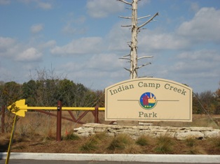
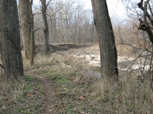
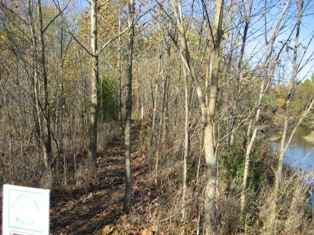
Mike Dunston, the trail steward for a couple of parks in St. Charles County has sent along some photos, and a description, which will eventually make its way to the GORC Trails page, of one of the newest parks there: Indian Camp Creek. ICC is located 7 miles north on US 61 between Wentzville and Troy. Turn left (west) on Dietrich Road, go .7 miles, turn right (North) into Park Entrance.
The trails are multiple use trails passing through cedar thickets, winding through the hillsides and skirting the bluffs along the creeks, through the flood plain of the Big Creek, and across several restored prairies, giving views of the numerous rock outcroppings, small ponds and historical relics ( e.g. flint chippings from Indians, farm homesteads, family cemetery).
The Black Eye Loop meanders along the Big Creek flood plain, giving little if any elevation change. Tight, twisty and wooded, it is primarily dirt with one or two very short stretches of sand. There are a couple dry creek crossings throughout that may require the novice to walk, but everything else is non-technical. The loop within a loop design allows you to ride the trail in both directions giving the rider different views of the Big Creek. A variety of wildlife abounds for the enjoyment of the trail users. To access the Black Eye Loop trail head, park at first parking lot past the bridge. Ride about 500 yards toward the Red Roof Pavilion. Entrance to the trail will be in the field on the right; it is marked with white carsonite signage.
The Cedar Thicket Hill Loop starts off with some small undulations in and out of the cedars that gradually grow into a short but semi-steep climb. At the top of the climb, the dirt tread transitions into a bed of (cedar needle type stuff) as the trail width is narrowed by the closely spaced cedar trees.
A large Park map showing the trails is located at kiosk near the equestrian parking lot (first gravel road to the right). These trails are shared with equestrians and hikers so please use appropriate etiquette. More trails are being developed on a continuing basis.
GORC's New Secret Weapon


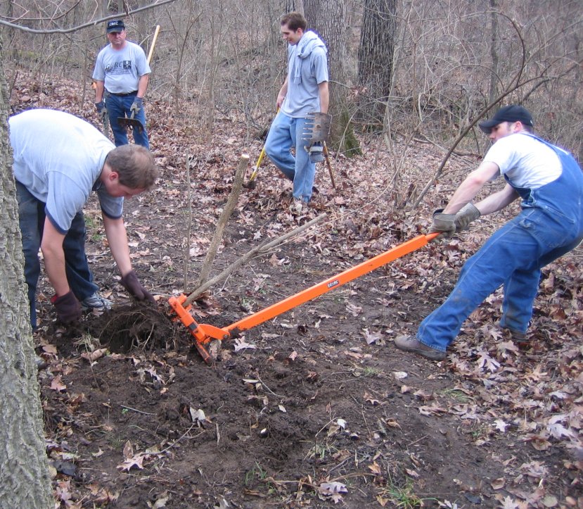
If you've been on any of the newest trails that GORC has been working on, you've probably been surprised at how fast so much trail is being built. On of the reasons, in addition to the super hard work and dedication of all of our volunteers, is this amazing piece of equipment, the Weed Wrench. In the past, where we had to spend a lot of time with pulaskis grubbing each and every sapling or small tree at the roots, now a single person or small crew can go along and remove them in a fraction of the time.
The retractable jaws clamp on to the base of the sapling, and then applying leverage to the handle closes the jaws and pops the tree out, rootball and all. Depending on which size you get, (we have the Heavy model), some stubborn ones will then require a few snips with loppers or a hack with a pulaski, but the efficiency is pretty amazing. It also seems like whoever is the lucky person to get on this detail doesn't want to give it up for the rest of the day! Why not come out to one of our workdays and give it a try yourself?
SIUE Workday- Saturday, December 16th
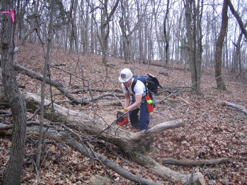
Thanks to the hard work last weekend of the approximately 30 volunteers who cleared all of the nearly 6 miles of existing trail at SIUE, we'll be able to spend this workday completely on the construction of the new Trail #4. The damage was impressive, requiring 4 hrs. of work for nearly every crew, of which there were 2 for each of the 3 trails. Kirby's crew also cleared the section under construction, so they worked for over 5 hours! As usual, the workday will begin at 9 am, followed by food, and a ride-- the weather looks like it will cooperate this weekend, yay!
SIUE Update
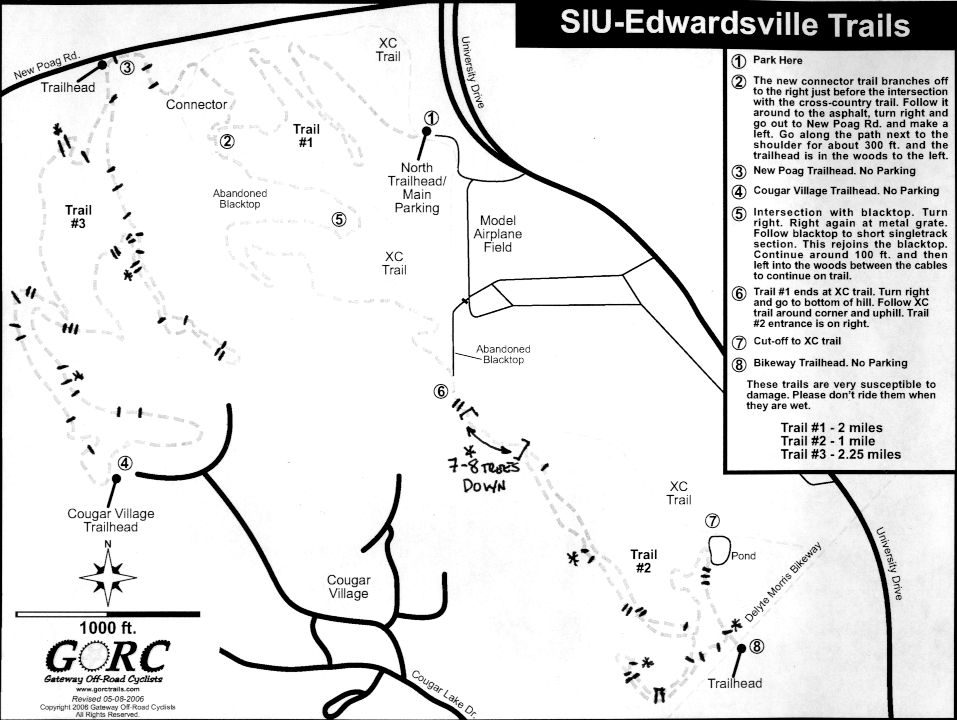
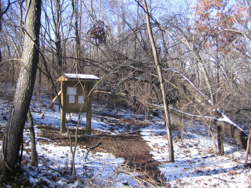
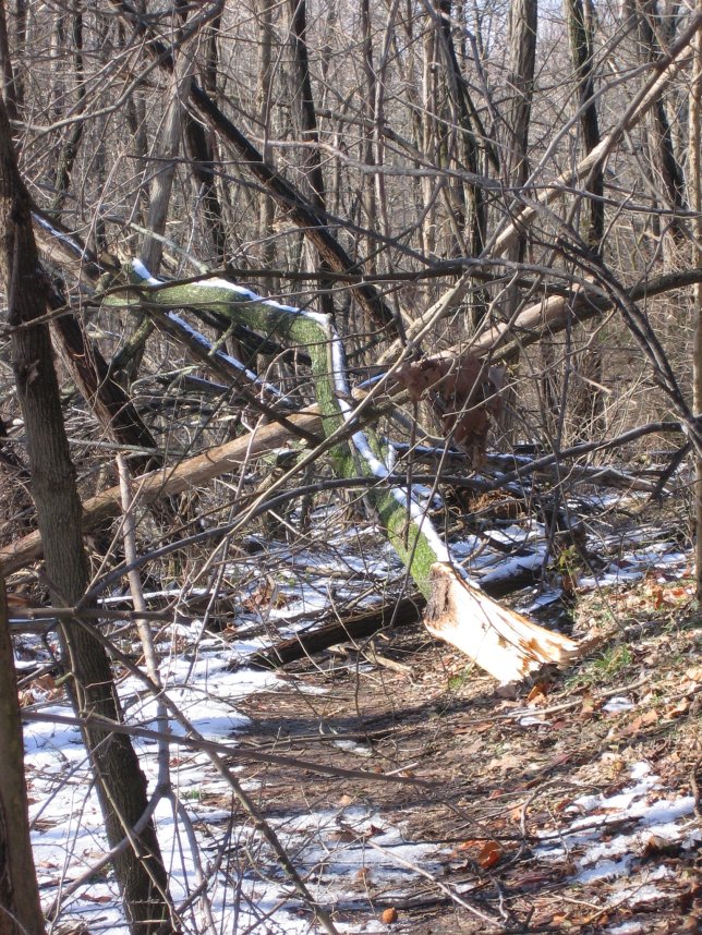
Well, we all knew that the ice storm had done major damage at SIUE. Here's a rundown: the map shows the downed trees which will require sawyer work. 34 on Loop #3, 21 on Loop #2. The ones marked with asterisks will require extra work. This does not even address the trees/branches which can be moved by hand or cut with loppers. Unfortunately, many of the downed trees also brought down tangles of grapevines or briars. It also does not include Loop #1, which others have looked at and discussed at some length. The kiosk on Loop #2 at the Morris Bikeway narrowly avoided being pulverized.
Unless there's a large turnout for the emergency workday on Sat. Dec. 9th, these trails will remain unrideable for some time to come. If you can spare the time, please come out and help. There's plenty of work to be done even if you're not a sawyer.
Castlewood Workday Cancelled 12/02/06
Due to a variety of weather related conditions, the workday for Sat. Dec. 2 has been cancelled. It will be rescheduled at a later date. The park is closed today (Friday), and it is unclear if it will be open at all tomorrow. The Bonkhard Adventure race scheduled for tomorrow has also been cancelled.
Subscribe to:
Posts (Atom)